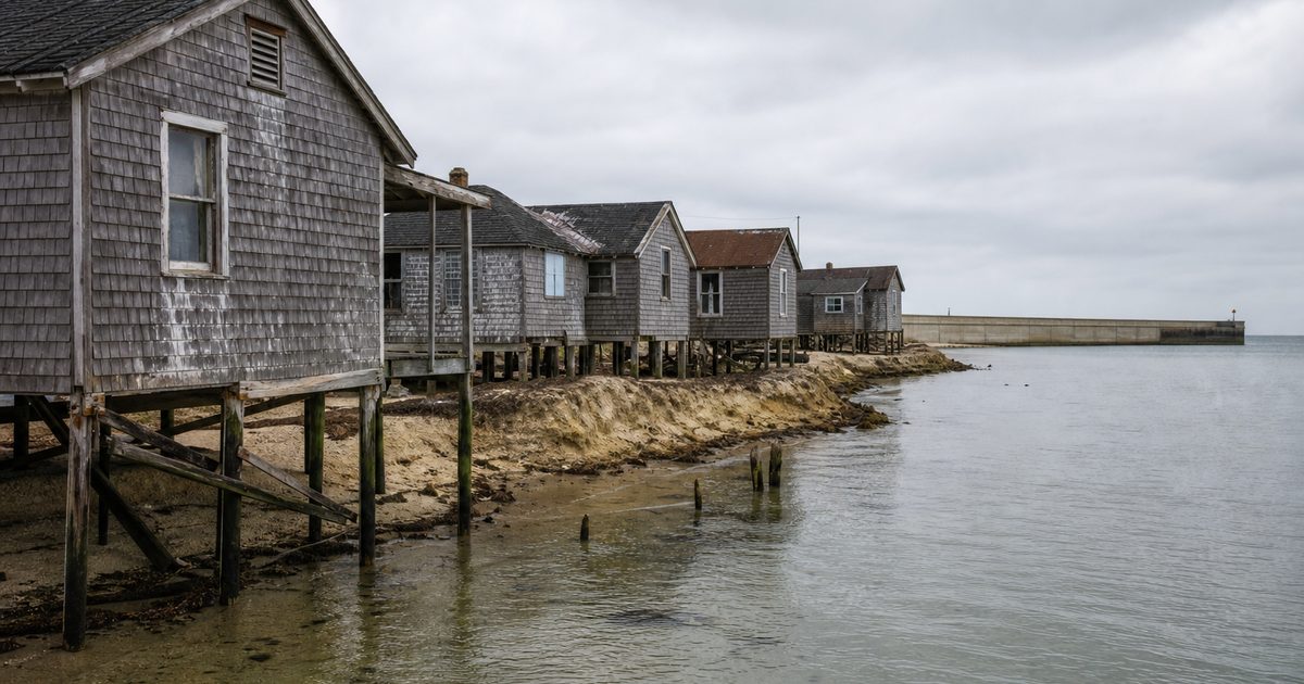
Utility poles stand in the water off Tangier Island, marking ground the shoreline has surrendered. Along other stretches, marsh grass thins into open water. Saltwater kills trees. High tides leave puddles in the streets, bringing the bay into the spaces between houses.
For the people living here, land loss is part of the town’s everyday geography.
Tangier lies in Chesapeake Bay, roughly 12 miles, or 19 kilometers, from Virginia’s Eastern Shore. Comparisons with maps dating to 1850 indicate that it has lost about two-thirds of its land. The remaining settlement occupies three low ridges separated by marshes and tidal channels.
Those ridges support a community whose work, family connections and distinctive speech developed around the water. Understanding what threatens them requires looking beyond the retreating shoreline. A place can become impossible to inhabit long before its last dry ground disappears.
Three ridges hold the town together
West Ridge, Main Ridge and Canton Ridge form the framework of Tangier’s settlement. Bridges cross the wet ground between them. Bicycles and golf carts move along narrow roads; boats occupy the working waterfront. The airport takes up part of West Ridge.
The 2020 census recorded 436 residents. That figure describes a small town, but its physical arrangement makes it unusually dependent on a few strips of habitable ground. Roughly 83 acres, or 34 hectares, have been identified as high enough to support habitation.
The distinction between habitable land and the island’s total area matters. Marsh can remain above water much of the time without supporting houses, roads or essential services. A ridge can lose its usefulness to a community while still appearing on a map.
Flooding therefore changes more than the outline of the shore. It changes the relationship between buildings, routes and services. The question is how long these pieces can continue to function together.
Even drinking water depends on reaching far below the surrounding saltwater. Shallow groundwater is saline, so the community draws fresh water from wells extending roughly 800 to 1,000 feet into the Potomac Aquifer.
The bay made settlement possible
Indigenous people used Tangier for fishing and hunting before European settlement. Stone tools and oyster-shell deposits preserve evidence of that earlier presence. Storms sometimes expose archaeological material along the shore, another consequence of land being disturbed and carried away.
The later European community included English families whose descendants remain on the island. Many residents trace their ancestry to John Crockett and other early settlers. By the late nineteenth century, harvesting oysters and crabs had become central to the local economy.
The bay was a workplace as much as a barrier. Mainland roads lay beyond the water, but the grounds that sustained a waterman’s livelihood were close at hand. Chesapeake deadrise boats, built for working these waters, remain part of the waterfront.
That history helps explain why moving is not simply a matter of exchanging one house for another. Family, church, boats and fishing grounds occupy a familiar, closely connected space. Relocation would rearrange those relationships, even if residents could find homes elsewhere.
Swain Memorial United Methodist Church is one expression of that continuity. So are the skills passed between generations on the docks and aboard boats. Their survival depends partly on people continuing to live and work near one another.
Why the shoreline is retreating
Three processes converge at Tangier: waves remove land, sea level rises, and the ground subsides.
Wave erosion is the easiest to see. Water undercuts an edge, vegetation loses its footing, and another piece of shoreline falls away. Research has estimated average land loss at around eight acres, or 3.2 hectares, a year over the periods studied. That is an estimate, not a fixed annual allowance: storms and local shoreline conditions affect how loss unfolds.
Relative sea level rise creates a different pressure. The term describes the height of the water compared with the land. Around Tangier, the sea is rising while the ground is sinking, increasing the change experienced at the shoreline.
Human-caused warming raises sea levels through ocean expansion and the melting of land-based ice. Regional subsidence adds to the problem. Part of that downward movement reflects the Earth’s continuing adjustment after the retreat of the Laurentide ice sheet thousands of years ago.
These processes leave different marks. Erosion cuts land away at the edges. Higher water levels allow tides to reach farther inland. Saltwater intrusion kills trees, and marshes can deteriorate into open water.
A seawall may slow the first process along a particular shore. It cannot, by itself, prevent the other two.
A forecast is not a departure date
Scientific studies have offered stark projections for Tangier’s remaining habitable ground. Under one mid-range sea level rise scenario, two inhabited ridges could become wetland during the 2030s, with the third following by 2051.
A paper published in 2021 also projected that the town’s population could reach zero by 2053.
Those dates describe different outcomes. Wetland conversion concerns the condition of the ground. Habitability concerns whether people can safely maintain homes and essential services. A population projection concerns whether residents remain. The three are connected, but they are not interchangeable.
Nor does a modeled date establish when the last household will leave. Outcomes depend on the pace of environmental change, protective works, economic conditions and decisions made by residents and public authorities.
The familiar description of Tangier as “disappearing underwater” can obscure this distinction. Some land could remain after maintaining a town becomes impractical. Repeated flooding might undermine daily life before permanent inundation reaches every house.
For residents, that uncertainty has practical consequences. Maintaining a home or investing in a boat involves a different calculation when the future of the surrounding settlement is in question. The difficulty lies in making ordinary decisions against forecasts that are serious but cannot provide an exact timetable.
What dispersal would change
Population decline puts pressure on the community before the water forces any final retreat. An aging population and empty or neglected houses make the contraction visible on land.
Tangier’s dialect gives that demographic change a further dimension. Its speech has attracted attention because of features associated with older forms of British English. Popular accounts sometimes describe it as surviving Elizabethan English, as though several centuries of linguistic change had passed the island by.
That description is misleading.
Linguist David Shores treated the dialect as a product of its own place and history. Isolation helped preserve certain features, while speakers continued to develop their language. The result belongs to a living community, not a preserved English past.
Its future depends on the settings in which people use it: family conversations, work aboard boats, encounters between neighbors. If households disperse, those settings change. Speech may persist among former residents and their descendants, but the dense network that supports it becomes harder to maintain.
Livelihoods face similar pressures. Crabbing and oystering tie work to particular waters, equipment and knowledge. Changes in the bay’s fisheries add uncertainty to the loss of habitable ground. Tourism provides another source of income, but it does not replace the working relationships that shaped the settlement.
The cultural consequences of retreat would emerge through these small, repeated disruptions: fewer children hearing local speech, fewer neighbors nearby, fewer opportunities to learn a trade within the community.
Why explanations matter
Residents and scientists have not always described Tangier’s predicament in the same terms.
Many islanders have emphasized erosion, the process they can watch removing their shoreline. Scientific assessments also identify rising relative sea level as a major threat, with climate-driven ocean rise and subsidence increasing exposure to flooding.
Erosion is real. The disagreement concerns how fully it explains the loss, and what follows from that explanation.
If waves are understood as the principal problem, a barrier against them appears to offer a solution. If rising water and sinking land are central, shoreline defenses become one part of a more demanding response.
Some residents have expressed their resistance through T-shirts declaring, “I refuse to be a climate change refugee.” The words convey attachment to home and rejection of an assumed future. They do not settle the physical questions, but they show why discussions framed entirely around eventual abandonment can fail to reach the people most affected.
Residents are making choices about a home, not merely responding to a case study.
What protection can buy
A seawall built along West Ridge in 1990 represents one attempt to hold the shoreline. Breakwaters and sand-and-dune systems are among the other measures proposed or considered for protection.
Each addresses particular conditions. A structure that reduces wave energy may slow erosion behind it. Maintaining higher ground or protecting infrastructure presents different demands. No single intervention resolves every mechanism of land loss.
The useful question is what a project protects, and for how long. Defending a stretch of shore may preserve homes or infrastructure without securing the whole settlement indefinitely. That limited benefit can still matter greatly to the people who depend on it.
Community investment has a different role. The Tangier Island Community Foundation seeks to support residents, heritage and a more resilient economy. Such work addresses the reasons people might remain, provided the ground and essential services can support them.
At the waterfront, these questions concern working boats and the people who use them. At a bridge, they concern the connection between one inhabited ridge and the next. Effective protection has to account for those connections as carefully as it accounts for the water.
FAQ
Is Tangier Island sinking?
Yes. The ground is subsiding while sea levels rise. Waves also erode the shoreline, so several processes contribute to land loss and greater flood exposure.
How much land has Tangier Island lost?
Research comparing historical maps with later surveys indicates a loss of approximately 67 percent since 1850. The shoreline continues to change.
When could Tangier Island become uninhabitable?
There is no certain date. One modeled scenario projects wetland conversion of the inhabited ridges by 2051, but habitability also depends on infrastructure, protection and community decisions.
Can a seawall save Tangier Island?
A seawall can reduce wave erosion along the shore it protects. It cannot alone stop sea level rise, subsidence or every route by which water reaches the settlement.
Why do residents want to stay?
Tangier is home to established families, churches and livelihoods rooted in the bay. Leaving would mean changing an entire network of work and community relationships, not simply moving house.