A low line of sand, on average just 7.2 feet above sea level, stands at the mouth of Mobile Bay. That narrow strip is Dauphin Island, Alabama’s only barrier island, and its importance lies in how much force it absorbs. Waves, storm surge, currents, river sediment, dredging, and rising water all meet here first.
The island is inhabited, but its central story is not really a human one. It is a story about movement. Sand arrives and departs. Storms open breaches. Tidal currents push material westward. One shoreline retreats while another extends. On a map, Dauphin Island can look settled. On the ground, and over time, it behaves more like a shifting edge.
A barrier island with an uneven foundation
Dauphin Island stretches about 15 miles and reaches roughly 1.75 miles at its widest point. Yet it is not one uniform body of sand. Its eastern end sits on an older core, part of the Pleistocene Citronelle Formation, an iron-stained silty-clay paleosol. That older material does not continue across the whole island. On the western side, it drops away.
That split matters. The east has a deeper geological backbone. The west is younger, lower, and easier for waves and storms to rearrange. Much of the visible surface across the island consists of Holocene beach sand and dunes, recent deposits in geological terms, laid down by the same coastal processes still at work now.
So when people ask what kind of landform this is, the answer needs nuance. Dauphin Island is a Gulf Coast barrier island, but not a tidy one. It is part inherited ground, part newly assembled shore. Its shape depends on the balance between older structure and fresh sediment.
The sand conveyor at the mouth of Mobile Bay
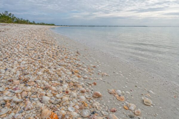
A barrier island survives only if sand keeps reaching it. Here, that supply comes largely through westward longshore drift, which carries sediment along the coast from the Florida Panhandle and across the Fort Morgan Peninsula. The beaches are not self-renewing by magic. They are fed grain by grain by a moving coastal system.
Mobile Bay also contributes sediment, along with the rivers that drain into it. Within that larger network, the Mobile River supplies a substantial share of the material that ultimately reaches the island, with the strongest contribution toward the eastern side and less influence farther west.
This is why Dauphin Island is fragile and persistent at the same time. It is fragile because any break in that sediment pathway leaves the shore exposed. It persists because it belongs to a much larger system of currents, river input, bay processes, and coastal transport.
The problem is that people have interrupted that system. Dredging for the Mobile Harbor entrance channel has reduced the natural flow of sand. Less sediment reaches the island, and erosion becomes harder to offset. That is one reason the question of Dauphin Island erosion cannot be reduced to storms alone. The island loses ground through a combination of natural dynamics and altered sediment supply.
One island, then two, then one again
Old charts tell a less stable story than modern road maps do. French and British maps from the 18th century indicate that Dauphin and Petit Bois once formed a single landform known as Isle Dauphin. Later, a breach separated them.
The island did not stop changing once it entered the historical record. A hurricane in 1916 cut a breach through Dauphin Island that remained open until 1942. Another storm opened a breach again in September 1948. By March 1950, aerial photographs showed the island had rejoined.
That pattern matters because it reveals what a barrier island actually is. Not a fixed outline, but a provisional one. The shore can split, reconnect, lengthen, and narrow without ceasing to be the same island. In that sense, Dauphin Island is best understood as a process rather than a permanent shape.
The long erosion phase
Across the Mississippi-Alabama barrier-island chain, land loss accelerated after the mid-19th century. On Dauphin Island, the modern pattern is usually described as a net erosional phase beginning in the late 1950s. “Net” is the key word. It does not mean every stretch of shore is shrinking at the same pace. It means that, overall, losses have exceeded gains.
Between 1958 and 2007, the island decreased in size by 16 percent. Along the Gulf shore, erosion rates reached 6.3 feet per year between 1942 and 1974. On the western end, shoreline recession has run about 2 to 3 feet per year.
Even so, the island’s history is not a simple tale of steady disappearance. Between 1917 and 1974, it also extended westward, adding about 1.8 miles of Gulf shoreline. That apparent contradiction is normal barrier-island behavior. Land is removed in one place and deposited in another. The island migrates, redistributes its mass, and changes form.
Then storms speed everything up. Hurricane Katrina in 2005 struck the low-lying West End especially hard and destroyed more than 350 feet of beach. On a coast this low, storms do not merely damage the landscape. They help make it.
Pelican Island and a rare natural gain
Not every chapter is about loss. In 2008, Pelican Island shifted north and welded onto Dauphin Island, adding sediment to the western end in a striking example of natural beach nourishment.
The event had been anticipated. In 1994, scientists documented tidal currents pushing sand from Pelican Island northwest toward Dauphin Island and predicted that the two landforms would eventually join. What looked sudden in 2008 had, in fact, been building for years.
That merger did not solve the island’s larger sediment deficit. It did show that natural coastal processes still move large volumes of material into place. For anyone trying to understand Dauphin Island Alabama, Pelican Island is a useful reminder that this coast is dynamic in both directions. It erodes, but it also builds.
Rising water, sinking land
Average elevation shapes everything here. At 7.2 feet above sea level, Dauphin Island has little margin for error. A modest increase in water level can push waves farther inland, attack dunes more often, and make low sections easier to breach.
Relative sea level around the island has risen by about 11 inches since 1966. The local problem is sharpened by subsidence, since the land itself is sinking. That means the effective rate of water rise is higher than the global average alone would suggest.
For a barrier island, this changes the rules. Beaches and marshes need more sediment simply to hold position. Storm surge reaches farther. Recovery after storms becomes harder. The debate, then, is not whether the island is under strain. It is how long nourishment, restoration, and protective works can keep pace with the combined effects of sea level rise, subsidence, and interrupted sand supply.
Some details remain under study, especially over longer timescales and in sorting the relative weight of human and natural causes in specific erosion patterns. The broader trend is clear enough: higher water, less room, more pressure.
Trying to hold the line
People have not stood aside while the shoreline changed. Some interventions have worsened the problem, especially where dredging has starved the island of sediment. Others aim to slow loss and protect what lies behind the island.
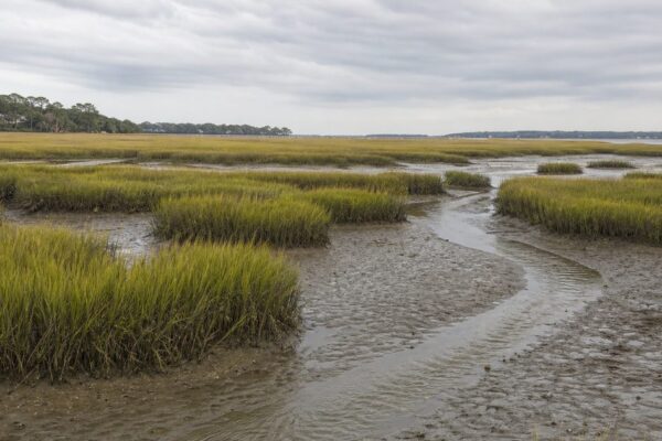
Near the Dauphin Island Causeway, restoration work has included segmented breakwaters and the placement of dredged sediment to protect the shoreline and rebuild marsh habitat. These projects make practical sense because the island is more than a beach. It is a protective margin for Mobile Bay, nearby wetlands, and the access routes that connect the island to the mainland.
That function helps explain why Alabama barrier island management is not just a matter of scenery. Dunes, marshes, and beaches are working parts of the coastal system. When they erode, the bay behind them becomes more exposed.
The West End shows this clearly. About 840 acres of coastal habitat there have been acquired by the state for conservation. Public access is limited, and that restriction is part of the point. Dune walkovers and fencing protect habitat used by coastal birds and sea turtles while also helping preserve the landforms that buffer the coast. On a barrier island, habitat protection and shoreline management often turn out to be the same task.
Human traces on a moving shore
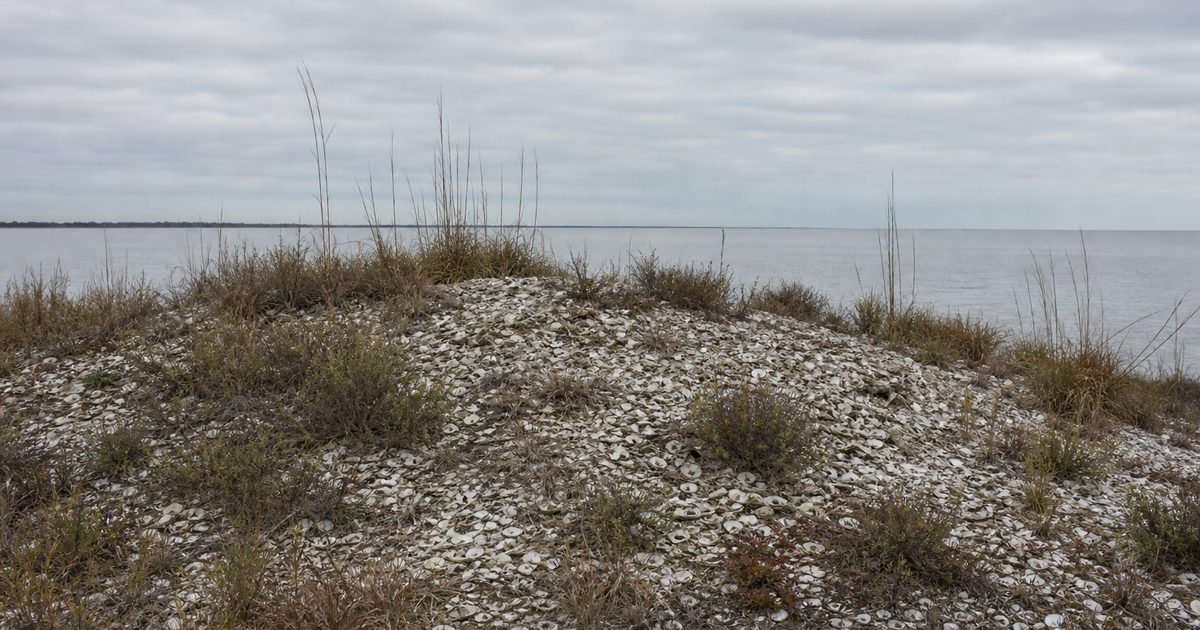
The island’s instability has shaped human history here for a long time. Native American groups, including the Creek, Seminole, and Choctaw, used Dauphin Island for hunting, fishing, and shellfish gathering at least as far back as the Mississippian Period, roughly 1000 to 1550 AD. Shell mounds remain as evidence of that long presence.
Those mounds also show how storms can disturb the past. When French explorers arrived in 1699, they found numerous skeletons exposed on the island and called it Massacre Island. The remains were not evidence of a recent massacre. They had come from a Native burial mound uncovered by a hurricane. In 1707, the island was renamed Isle Dauphine after the Dauphin of France.
Folklore gathered here as well, though it should stay in its proper category. Tradition says Prince Madoc of Wales visited in 1171. Another story tells of a jeweled cross dropped into a well during an English pirate raid around 1710. Jean Lafitte is also linked in local legend to buried treasure somewhere near Mobile Bay. None of these tales carries the weight of the island’s documented coastal history. What does endure, in plain view, is the way storms bury and expose human traces just as they reshape the shore itself.
Reading the island today
Some parts of Dauphin Island still make that long story visible. On the north side, the Indian Shell Mounds preserve evidence of early Native use. On the eastern end, Fort Gaines stands at the bay entrance, a reminder that this shifting island also held strategic value.
Elsewhere, the evidence is less monumental and more physical. The western end shows the ongoing push and pull of erosion and accretion. Near the causeway, restoration structures sit beside nourished shorelines. The Dauphin Island Sea Lab studies the surrounding coastal system, while the Audubon Bird Sanctuary reflects another function of this narrow strip of land: it serves as a stopover for migratory birds crossing the Gulf.
That wider ecological role does not replace the island’s barrier function. It grows from it. The same geography that shelters Mobile Bay also creates habitat, marsh edge, dunes, and resting ground for birds. To understand Dauphin Island, you have to see it not as a static wall between bay and Gulf, but as a moving coastal margin that still works even while it changes.
FAQ
How long is Dauphin Island?
Dauphin Island is about 15 miles long.
Is Dauphin Island eroding?
Yes. It has been in a net erosional phase since the late 1950s, though some sections also gain sand as the island shifts.
What protects Mobile Bay from the Gulf of Mexico?
Dauphin Island serves as the main barrier island at the mouth of Mobile Bay, absorbing wave energy and storm impact from the Gulf.
What is the average elevation of Dauphin Island?
The island’s average elevation is about 7.2 feet above sea level.
Why is Dauphin Island important?
It protects Mobile Bay, supports marsh and dune habitat, and shows how a Gulf Coast barrier island forms, erodes, and rebuilds over time.