At Kwajalein, 16.4 square kilometers of land enclose a lagoon covering roughly 2,174 square kilometers. Almost everything inside the reef is water. Along its rim, 97 islands and islets provide the scarce ground on which people have built homes, airfields, fortifications and radar stations.
That imbalance helps explain why this Marshallese atoll became a Japanese naval base, an American battlefield and a missile-testing site. The lagoon offered sheltered water; the islands offered footholds. Later, their position in the Pacific made them useful places to watch weapons arriving from thousands of kilometers away.
The consequences extend beyond military engineering. Across a short stretch of water from the restricted American installation, densely settled Ebeye houses a Marshallese community whose daily life reflects decades of relocation and employment tied to the base. Here, the military history is also a history of access to land.
A military geography made of coral
Kwajalein belongs to the Ralik, or western, chain of the Marshall Islands, about 3,900 kilometers southwest of Honolulu. Its reef developed over submerged volcanic foundations as coral growth kept pace with changing sea levels and the slow subsidence of the underlying rock.
The resulting islands are low and narrow, averaging roughly 1.8 meters above sea level. Kwajalein Island, at the southern end of the atoll, is about four kilometers long. Its approximately 3.1 square kilometers account for a substantial portion of the atoll’s land.
Outside the reef, the seabed falls steeply. Inside lies one of the world’s largest lagoons. Much of the intervening reef emerges at low tide and disappears beneath the water again as the tide rises.
Passages interrupt that boundary. Their depth and width determine which vessels can enter and where they can go. A lagoon may look open on a map, but ships must approach it through particular channels.
For military planners, this combination offered useful possibilities: sheltered anchorage, controlled approaches and islands on which to build facilities. It also imposed limits. Every runway, gun position or settlement occupied part of a very small supply of habitable ground.
The apparent emptiness of the water can obscure that scarcity. A large atoll is not necessarily a place with much room to live.
An inhabited atoll becomes a fortified base
Foreign powers did not arrive at an unclaimed military site. Marshallese communities already maintained systems of landholding, chiefly authority and movement between islands. Nell, for example, traditionally served as a seat of power for Marshallese chiefs, known as iroij.
Germany established a protectorate over the Marshall Islands in 1885. Japan seized the islands during the First World War and subsequently administered them under a League of Nations mandate. These changes placed an inhabited archipelago within successive imperial systems.
Before and during the Second World War, Japan developed Kwajalein into an important naval and air base. Facilities occupied islands at opposite ends of the lagoon, including Kwajalein Island in the south and Roi and Namur in the north.
The reef’s scale mattered. An attacker could not capture one position and assume control of every other installation. Forces had to cross or work around a broad expanse of water, then fight on separate strips of land.
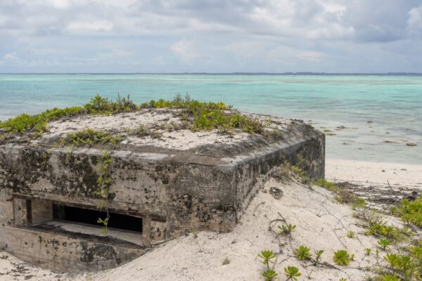
Japanese defenses included bunkers, gun emplacements and other concrete works. Some survive, but their weathered appearance can make the base seem more distant from ordinary life than it was. Construction, supply and defense all depended on labor and shipping. The war brought those networks, and the people within them, under attack.
Fighting at opposite ends of the lagoon
American air attacks struck the atoll before the landings, damaging installations and sinking vessels. Operation Flintlock began on January 31, 1944, with assaults on outlying islands and preparations for the main attacks.
On February 1, the U.S. 7th Infantry Division landed on Kwajalein Island. At the northern end of the atoll, the 4th Marine Division attacked Roi and Namur.
Naval gunfire and aerial bombardment had battered the defenses. Yet surviving Japanese positions still required close combat. On these narrow islands, the fighting compressed into bunkers, damaged buildings and short stretches of exposed ground.
American forces secured Roi-Namur by February 2 and declared Kwajalein Island secure on February 4. Thousands of Japanese personnel died; comparatively few became prisoners. American forces also suffered hundreds of deaths and many more wounded across the operation.
The brevity of the battle on a campaign map should not suggest an easy occupation. Nor do military casualty totals fully describe those caught in it. The Japanese garrison included Korean laborers, and Marshallese civilians also faced the violence of bombardment and invasion.
Capturing the atoll gave the United States a base deeper within the Japanese-controlled Pacific. The same lagoon that had supported Japanese operations now served American forces. Its strategic value survived the destruction of the installations around it.
The wreck that came from Bikini
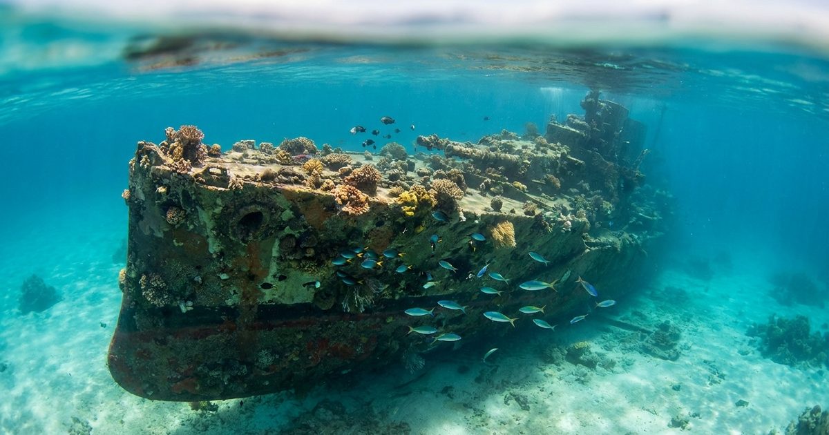
Below the lagoon’s surface, wrecks preserve several different histories. Some vessels sank during wartime attacks. Other ships and aircraft reached the bottom through postwar disposal. Their presence does not mean that every wreck marks a battle site.
The German heavy cruiser Prinz Eugen is the clearest example.
After Germany’s surrender, the United States took possession of the ship and used it as a target in Operation Crossroads, the atomic bomb tests at Bikini Atoll in 1946. The cruiser survived the explosions and later reached Kwajalein.
Leaks subsequently caused it to capsize and sink in December 1946. It was not a casualty of the 1944 battle, nor was it deliberately scuttled.
That distinction matters because Kwajalein and Bikini occupy different places in the history of American weapons testing. The Crossroads detonations took place at Bikini. The cruiser’s wreck links Kwajalein to those tests without making this lagoon their location.
The ship also left a material problem long after its military usefulness ended. Decades later, an American-led operation removed much of the oil remaining aboard, addressing the risk of leakage into the lagoon.
A battlefield becomes an instrument
After the war, Kwajalein became part of the United Nations Trust Territory administered by the United States. The military retained its foothold, but a new kind of weapons program changed the purpose of the base.
In the late 1950s, the U.S. Army developed facilities here for the Nike Zeus anti-ballistic missile program. Missile testing became a lasting role.
Distance now counted differently. Rather than protecting a naval anchorage, the atoll provided an observation point near the receiving end of long-range test flights across the Pacific. Instruments could measure an incoming object’s path, examine its characteristics and record its descent.
The Ronald Reagan Ballistic Missile Defense Test Site, commonly called RTS, operates facilities distributed across several islands. Its equipment includes precision tracking radars, optical sensors and telemetry stations. Systems such as TRADEX help researchers distinguish what an object is doing from what a distant observer might otherwise infer.
Some tests involve unarmed ballistic missiles launched from the continental United States toward designated impact areas near Kwajalein. Other activities support missile-defense research and space surveillance.
The lagoon should not be imagined as a single target basin into which every test missile falls for recovery. Impact locations and recovery arrangements depend on the test. The wider ocean, as well as the atoll’s instruments, forms part of the operating environment.
Small islands separated by water have become components of one measurement system. Their usefulness depends on their positions relative to one another and to events far beyond the reef.
Ebeye and the cost of scarce land
Military use reserved land and restricted movement. Marshallese relocations, including transfers associated with testing operations, helped concentrate people on Ebeye.
The island covers only a few dozen hectares and supports thousands of residents. It is the administrative center of the Kwajalein Atoll Local Government, as well as a community closely connected to employment at the American installation.
About seven kilometers separate Ebeye from Kwajalein Island. The contrast across that water is pronounced: a crowded civilian settlement faces a controlled military site with an airfield, housing and technical infrastructure.
Marshallese employees commute to jobs on the leased islands. Those journeys make the relationship tangible. The base depends partly on workers whose homes lie outside its perimeter, while their community faces persistent pressure on housing, water, sanitation and other services.
Describing Ebeye simply as overcrowded misses the history behind the density. Its settlement pattern reflects decisions about which land could remain available to Marshallese residents and which land military operations would occupy.
The Republic of the Marshall Islands is now sovereign, in free association with the United States. American use of land at Kwajalein continues through agreements and leases. Sovereignty, customary land rights and military access therefore overlap here rather than fitting into a simple division between an American island and a Marshallese one.
A working range, not an open-air museum
The surviving bunkers, underwater wrecks and operating radars occupy the same atoll, but they do not form an unrestricted heritage site.
Kwajalein Island remains a controlled military installation. Arrival at Bucholz Army Airfield does not grant permission to explore the base. Civilian passengers traveling onward must follow the applicable entry and transfer arrangements, often continuing to Ebeye.
The same caution applies to descriptions of wreck diving. Access enjoyed by authorized residents or organized groups does not establish public access to leased islands or surrounding facilities.
Environmental pressures cross these boundaries more easily. Low elevation exposes settlements and infrastructure to wave flooding, while sea-level rise adds to long-term concerns. Old wrecks, wartime debris and the legacies of military activity create other management responsibilities.
On a tracking screen, an island can appear as a set of coordinates. On Ebeye, the same geography determines how closely homes stand together and how far a worker must travel before a shift begins.
FAQ
Why is Kwajalein used for missile testing?
Its location allows instruments to observe long-range test flights across the Pacific. Radars, optical equipment and telemetry stations support missile-defense research and space surveillance.
How large is Kwajalein’s lagoon?
The lagoon covers approximately 2,174 square kilometers. The surrounding 97 islands and islets together contain about 16.4 square kilometers of land.
What happened at Kwajalein during World War II?
American forces attacked the Japanese-held atoll during Operation Flintlock in 1944. They secured the principal positions on Roi-Namur and Kwajalein Island in early February.
Were atomic bombs tested at Kwajalein?
The Operation Crossroads atomic tests took place at Bikini Atoll, not Kwajalein. The Prinz Eugen survived those tests before capsizing and sinking in Kwajalein’s lagoon.
Can tourists visit Kwajalein Island?
Access to the military installation requires authorization. Civilian travel through its airfield does not include permission to visit the base, its historic remains or its recreational facilities.