On March 1, people across the Marshall Islands mark Remembrance Day. The date points to a single blast at Bikini Atoll, but its meaning reaches far beyond one crater in one lagoon. It names a history of removal, fallout, illness, disputed science, and land that could not simply be given back by declaring it safe.
Between 1946 and 1958, the United States conducted 67 nuclear tests in the Marshall Islands: 23 at Bikini and 44 at Enewetak. Their combined yield was 108 megatons. One common comparison puts that force at roughly the equivalent of a Hiroshima-sized bomb every day for twenty years. The scale matters, but the deeper story lies in what that force did to coral atolls where land is scarce, kinship is rooted in place, and displacement is never just a matter of moving people from one point on a map to another.
This is the nuclear history of the Marshall Islands, told through its lasting consequences on land and on Marshallese life.
The atolls as testing ground
The first detonations came almost immediately after the Second World War. On July 1, 1946, the United States carried out Shot Able at Bikini Atoll as part of Operation Crossroads. On July 25, Shot Baker followed in the same lagoon, this time underwater. Baker spread radioactive contamination more widely than planners had expected. Early on, the tests showed that a coral atoll was not a sealed arena where damage could be neatly contained.
The political setting mattered as much as the geography. In 1947, the Marshall Islands became part of the Trust Territory of the Pacific Islands, administered by the United States under United Nations authority. The same government that oversaw the territory also made the decisions about evacuation, return, cleanup, and compensation.
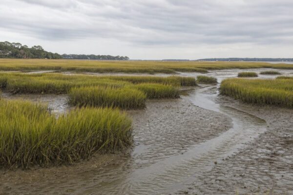
That authority fell on a place unlike a continental test site. The Marshall Islands stretch across a vast area of ocean, yet the total land area is small. Atolls are narrow rings of coral land around lagoons. A village, a burial ground, a breadfruit stand, and a shoreline path may sit only a short walk apart. In Marshallese society, where land tenure is bound up with matrilineal lineage, losing land meant more than losing shelter. It meant losing the physical setting of memory, obligation, and everyday life.
Bikini and Enewetak after removal
Bikini is the name most outsiders know, but Enewetak was also transformed by the testing program. Bikini’s people were removed in 1946. Enewetak’s residents were forced to leave in 1947 ahead of Operation Sandstone, which began in 1948. Their atoll would eventually host 44 tests.
Then the weapons changed. On November 1, 1952, Ivy Mike was detonated at Enewetak Atoll. It was the first full-scale thermonuclear test. That moment marked a shift in the Marshall Islands nuclear history. The United States was no longer testing only atomic bombs of the kind used in war. It had entered the hydrogen bomb era, with far greater destructive power.
The damage was not abstract. Tests tore apart islands, contaminated soil and vegetation, and made return uncertain for years or generations. Bikini Atoll residents were allowed back in 1969, then removed again in 1978 after radiation exposure was found to be too high. That sequence became part of the pattern: removal, reassurance, return, renewed alarm, another departure.
It is hard to overstate what that did to trust. A state can move people by order. It cannot easily persuade them, after repeated reversals, that official promises about safety deserve belief.
Castle Bravo and the fallout that did not stay put
At dawn on March 1, 1954, Castle Bravo detonated at Bikini Atoll. The device yielded 15 megatons, far above the predicted 6 megatons. It remains the largest nuclear test ever conducted by the United States.
The blast physically altered the atoll. It vaporized two islands and part of a third, leaving a crater in Bikini lagoon about 1.6 kilometers wide and 61 meters deep. A mile-wide scar is a useful image, but the crater is only the most visible part of the event.
The fallout spread across inhabited atolls. Rongelap and Utirik were contaminated, along with a much wider area. On Rongelap, people described a fine white powder falling from the sky. Children played in it and ate it, not knowing it was radioactive fallout. Residents were evacuated two days later. That delay remains one of the starkest facts in the history of nuclear testing in the Pacific.
Castle Bravo also carried fallout far beyond the Marshall Islands. Reports detected radioactive material across a broad swath of the Pacific and beyond. The test is often remembered for its yield. In Marshallese memory, its meaning is more intimate than that. It entered bodies. It touched skin, food, drinking water, pregnancies, and the thyroid glands of children.
Illness, exposure, and contested science
The human record is plain enough on the central points. Marshallese communities from Bikini, Enewetak, Rongelap, and Utirik were displaced and exposed to radiation. Exposure has been linked to increased rates of thyroid cancer and other cancers, including leukemia, as well as miscarriages, stillbirths, and severe birth defects.
One of the most painful phrases in this history is “jellyfish babies,” used in Marshallese communities for infants born with profound abnormalities, including translucent skin and absent or poorly formed bones. The term is not literary embellishment. It is a local language of grief.
The aftermath also produced a second wound: uncertainty over how much officials knew, and when. After Castle Bravo, the United States began Project 4.1, a medical program to study radiation effects in exposed Marshallese populations. That history remains contested in an important way. Some historical documentation and scholarship suggest that scientists within the Atomic Energy Commission were interested in the opportunity to study human beings living in contaminated environments, and that this interest may have shaped decisions such as the return of Rongelap residents in 1957.
That is not the same as settled proof of motive. In the 1990s, the Advisory Committee on Human Radiation Experiments concluded that it found no evidence that the original exposures were caused in order to study their effects. The distinction matters. So does the fact that many Marshallese saw little reason to trust the institutions managing the aftermath. In the Marshall Islands, debate over intent cannot be separated from lived experience of exposure, delayed evacuation, and repeated assurances that later proved unreliable.
Return, compensation, and the long afterlife of the tests
Formal testing ended in 1958. The nuclear era in the Marshall Islands did not end with it. It changed form.
In 1957, Rongelap residents were returned to their atoll despite concerns from some scientists that contamination remained dangerous. In 1985, Greenpeace evacuated the population of Rongelap after years of local fear and protest over radiation levels. The date matters here: the removal happened in 1985, not 1984.
By then, the argument had shifted from blasts to aftermath. What counts as adequate compensation for land that cannot be safely used? What does medical care look like when exposure stretches across generations? What does justice mean when contamination outlasts the political moment that produced it?
The Marshall Islands became independent in 1986 under the Compact of Free Association with the United States. That same year, the two governments agreed to a $150 million nuclear compensation settlement. In 1988, the Marshall Islands Nuclear Claims Tribunal was established to hear and award claims.
The adequacy of that settlement remains disputed. The United States has treated the 1986 agreement as full and final. The tribunal later awarded sums far beyond the original settlement and identified total damages that it could not pay from available funds. It eventually became largely inactive after running out of money. For Marshallese claimants, legal recognition without payment did not resolve the underlying loss.
This is one reason the nuclear history of the Marshall Islands still feels unfinished. It lives in court records and diplomatic language, but also in the simpler fact that some communities could not return home in any durable sense.
The landscape that still carries the history
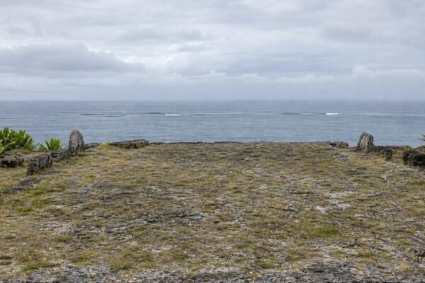
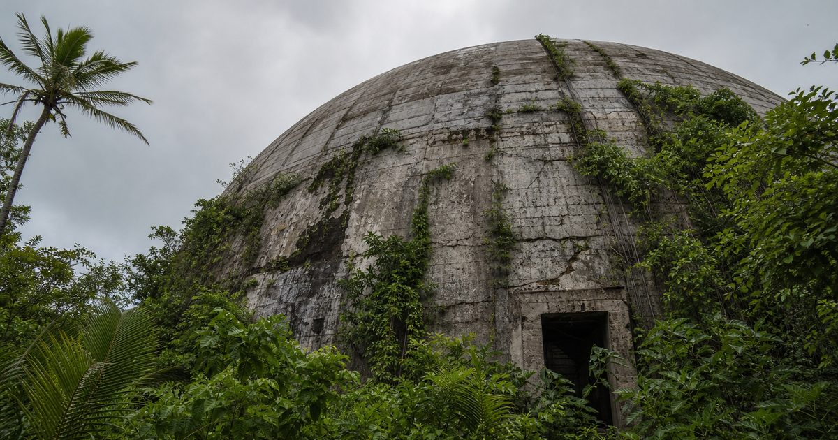
Some places in the Marshall Islands make the legacy visible at a glance. On Enewetak Atoll, the Runit Dome, also known as Cactus Dome, covers radioactive waste under a concrete cap. On Bikini, the lagoon still contains the sunken warships of Operation Crossroads, and nearby lies the crater left by Castle Bravo.
Yet the most important traces are less dramatic than a dome or a crater. They sit in soil, food systems, and settlement patterns. Bikini and Rongelap remain largely uninhabited because of radioactive contamination. Programs tied to the US Department of Energy have long focused on Bikini, Enewetak, Rongelap, and Utirik, where the testing legacy has been most acute.
The demographic map of the country also bears the mark of displacement. A large share of the population now lives in Majuro and Ebeye on Kwajalein Atoll. Some displaced communities settled elsewhere, including Rongelapese families on Ejit Island in Majuro Atoll. That redistribution was not caused by nuclear testing alone, but the tests helped drive a concentration of people away from ancestral atolls and toward crowded urban centers.
This is where the story becomes more than Cold War history. In a low-lying coral nation, contamination and climate vulnerability now overlap. Land made precarious by radiation faces a second form of precarity through sea-level rise and coastal erosion. The result is not a neat sequence in which one crisis ended and another began. They sit on top of each other.
Remembrance Day in a scattered country
On a map, the Marshall Islands can look like tiny marks across a huge field of ocean. The country consists of two chains, Ratak in the east and Ralik in the west, spread across roughly 1.9 million square kilometers of sea. The nuclear age made several of those atolls globally famous, but in a way that flattened them into test names and blast yields.
Remembrance Day restores the human scale. It recalls that Bikini and Rongelap were not empty laboratories. They were inhabited places with lineages, graves, reef knowledge, and ordinary routines. The history of nuclear testing in the Marshall Islands is therefore not only a military story and not only an environmental one. It is a history of how state power entered intimate life through land, food, illness, and forced absence.
The crater at Bikini is still there. So is the dome on Enewetak. But the more enduring legacy may be harder to photograph: a national memory organized around places many people cannot safely live in, and a political argument that has never fully closed.
FAQ
How many nuclear tests were conducted in the Marshall Islands?
The United States conducted 67 nuclear tests there between 1946 and 1958.
What was Castle Bravo?
Castle Bravo was a US thermonuclear test detonated at Bikini Atoll on March 1, 1954. At 15 megatons, it was the largest nuclear test ever conducted by the United States.
Which atolls were most affected by nuclear testing in the Marshall Islands?
Bikini and Enewetak were the main test sites. Rongelap and Utirik were heavily affected by fallout, especially after Castle Bravo.
Are Bikini and Rongelap inhabited today?
Both are largely uninhabited because of radioactive contamination and the long-running difficulty of safe permanent resettlement.
Did the United States compensate the Marshall Islands for nuclear testing?
Yes. A $150 million settlement was agreed in 1986, but many Marshallese and the Marshall Islands government consider it inadequate.