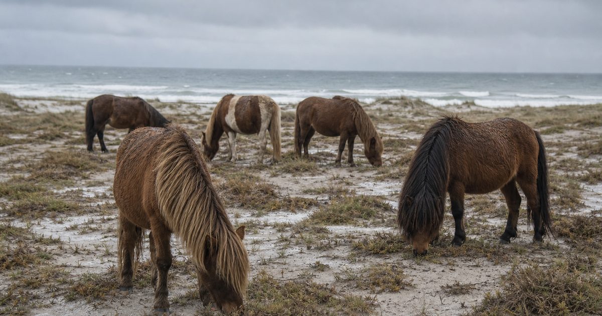
Two million people come to Assateague each year, and many of them are looking for ponies on the beach. The famous image is easy to grasp: a compact horse in the surf, mane blown sideways, dunes behind it. The harder truth is that the animal only makes sense if you look down at the sand under its hooves.
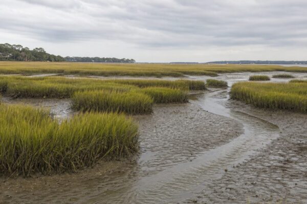
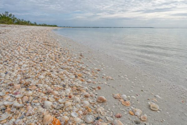
Assateague Island is a long, narrow barrier island off the Delmarva Peninsula, about 37 miles in length and rarely more than a mile wide. It spans Maryland and Virginia. No town sits on it now. What remains is a strip of beach, dune, marsh, shrubland, maritime forest, grassland, and freshwater ponds that never settles into a final shape. Wind moves it. Waves pare it back. Storms cut across it and throw sand inland. The island is less a fixed place than a process.
That process explains the horses better than the legend does. The Assateague horses are feral, not wild: descendants of domestic animals living free on a barrier island that is always eroding, rolling over, and rebuilding itself. Their numbers, their diet, even their squat appearance are part of that unstable ecology.
An island that survives by shifting
A barrier island looks solid on a map. On the ground, it is provisional.
Assateague belongs to the Atlantic Coastal Plain, shaped over long spans by sediment deposition, sea-level change, and the older geological history of the region. The deep background matters, but the visible island is made by more immediate forces. Sand arrives, moves, and disappears. Dunes rise and flatten. Marsh edges creep. Shorelines retreat.
Storms do much of the work. During a major coastal storm, water can wash over the beach and dunes, carrying sand from the ocean side toward the bay. That sand may settle in broad sheets or fans on the back side of the island. Geologists call the larger pattern barrier island rollover. The term is plain, but the effect is dramatic: the island shifts landward, inch by inch and storm by storm, toward the mainland side.
On Assateague, erosion is only half the story. Sand lost in one place often becomes new ground somewhere else. A dune cut down by surf may reappear as an overwash deposit farther inland. A marsh edge may collapse, while another patch of marsh forms where sediment accumulates. Change is not an interruption of the system here. It is the system.
That is why attempts to hold one section still can unsettle another. At the island’s northern end, jetties built for Ocean City interrupted the natural southward drift of sand. Less sand reached that part of Assateague, and erosion worsened. The lesson is simple enough: on a coast built to move, stopping movement has consequences.
The ponies are a product of that coast
The horses draw the eye, but they are not relics of untouched nature. They are feral animals, descended from domesticated stock. Their origin is still disputed. Local tradition says they survived a Spanish shipwreck off the Virginia coast in the 17th century. Historians have long offered a more ordinary explanation: settlers likely placed horses on the island to avoid taxes on livestock and to escape fencing requirements on the mainland. The shipwreck belongs to folklore. Domestic ancestry does not.
Today the animals are divided into two herds by a fence near the Maryland-Virginia line. The split is administrative as much as physical. In Maryland, the National Park Service manages the herd. In Virginia, the Chincoteague Volunteer Fire Company owns and manages the herd associated with the well-known Pony Swim.
The setting is harsher than the postcard suggests. Grazing on a barrier island means living on a salty, limited diet. Assateague horses feed on saltmarsh grasses, dune grasses, rose hips, bayberry, and persimmons. Fresh water can be scarce. The forage is not especially rich. Those conditions help explain the animals’ small stature and the pot-bellied look visitors often mistake for a breed trait or a sign of abundance. It is neither. It is a clue to life on a narrow island where salt, heat, insects, and poor forage shape the body.
Researchers have monitored the Maryland herd regularly since 1975, tracking health and population dynamics over decades. That long record reflects a basic ecological fact. A feral horse population on a shifting barrier island cannot grow without limit and leave the landscape unchanged.
Why horse numbers shape the island
The central question on Assateague is not whether the ponies belong. They have been part of the island’s human and ecological story for centuries. The real question is how many the island can absorb.
Vegetation does far more than soften the view. On dunes, plants such as American beachgrass trap blowing sand and help build the ridges that buffer storms. In salt marshes, species such as smooth cordgrass hold sediment in place and create habitat. On a barrier island, roots are structural. Remove too much plant cover and the island becomes more vulnerable to wind, overwash, and erosion.
Heavy grazing once put that structure under pressure. Horses reduced native vegetation, including American beachgrass, and affected nesting habitat for birds. This was not just a matter of a few cropped plants. It altered the mechanics of the island. Less grass on dunes meant less stability. Disturbed marsh and upland vegetation changed how other species used the landscape.
Management shifted in response. Since the mid-1990s, horse population control has been a central part of protecting the barrier island ecosystem. In Maryland, the National Park Service aims to keep the herd at roughly 80 to 100 animals, using contraceptive vaccines delivered to mares by dart. In Virginia, the herd is managed under permit at about 150 adult animals. Foals are removed through the annual roundup and auction linked to the Chincoteague Pony Swim tradition.
The effect has been visible in the plants. Native species, including American beachgrass and smooth cordgrass, have recovered in places where grazing pressure eased. That recovery matters because it strengthens the island’s own defenses. More beachgrass helps dunes build and hold. Healthier cordgrass supports marshes that absorb wave energy and trap sediment. On Assateague Island, horse management is really landscape management.
Storms keep rewriting the habitat
A storm does not simply damage Assateague. It rearranges it.
After overwash, a stretch of dune may be lower, a pond saltier, a marsh edge newly cut, a patch of shrubland buried in sand. The island’s habitats sit close together, compressed into a narrow band. Beach gives way to dune, dune to shrub thicket or maritime forest, low ground to marsh or freshwater pond. None of those boundaries is permanent.
That shifting mosaic helps explain the island’s biodiversity. Assateague supports around 300 bird species over the course of the year. Herons and egrets work the marshes. Snow geese arrive in season. Piping plovers use open beach habitat, and their nesting areas are vulnerable precisely because the habitat is so exposed. Mammals include white-tailed deer, raccoons, red foxes, opossums, river otters, muskrats, meadow jumping mice, and voles. In the marshes and bays live blue crabs, Atlantic menhaden, summer flounder, ribbed mussels, and oysters. Reptiles and amphibians add another layer, including freshwater turtles and sea turtles such as the loggerhead.
The important point is not that the species list is long. It is that many of these animals depend on habitats created, damaged, and recreated by disturbance. Open sand for shorebirds may come from recent storm action. New sediment on the bay side can help build marsh. Saltwater intrusion may erase one freshwater pocket and set up another elsewhere later on. Loss and renewal happen together.
That is also why access restrictions matter. In the Virginia Over Sand Vehicle area, the Hook is closed during part of the nesting season to protect piping plovers. Such rules are not bureaucratic fussiness. On a thin edge of sand, one breeding stretch can make a measurable difference.
Human lines on a moving island
Assateague is often described as undeveloped, and compared with much of the Atlantic coast that is true. But people have been trying to use, settle, manage, and stabilize this island for a long time.
The old village near the lighthouse is one reminder. The Assateague Lighthouse, completed in 1867, still stands on the Virginia end, 142 feet tall, with 175 cast-iron steps. Nearby once stood Assateague Village, where residents farmed, kept livestock, and tried to make a life on land that storms repeatedly tested. On the mainland side near Assateague State Park, the Rackliffe House points to an older history of plantation agriculture tied to this coast.
The modern island is divided among agencies: the National Park Service, the Maryland Department of Natural Resources, and the U.S. Fish & Wildlife Service. That patchwork reflects practical realities, but it also underscores a larger tension. Roads, parking lots, trails, fences, and visitor facilities assume a degree of stability. The island itself does not offer it.
Even the map resists convenience. There is no road connecting the Maryland and Virginia districts along the island. To move between them, you leave the coast, return to the mainland, and enter again elsewhere. That awkwardness is revealing. Assateague may look like one continuous strand of sand, but in practice it behaves like a restless margin where weather still sets the terms.
The harder future for a moving coast
The forces shaping Assateague are old. The pressure on them is not.
The island receives heavy visitation, and that brings wear to infrastructure as well as money to nearby communities. Roads, parking areas, trails, and visitor facilities all sit in a place where storms can undercut, flood, or bury them. Coastal resilience work has tried to reduce some of that damage, especially around developed access points.
The larger issue is sea-level rise and storm intensity. On a barrier island, those are not abstract climate metrics. They mean faster shoreline retreat, more frequent overwash, greater saltwater intrusion, and sharper pressure on the thin balance between fresh and salt water in ponds and wetlands. They also raise a difficult question for managers: how much room will the island be allowed to have?
Because Assateague survives by moving. Westward rollover is not a flaw in the system; it is how the system persists. The problem comes when roads, parking lots, and fixed expectations insist that the island stay where people last found it. The future of the Assateague ponies, the dunes, and the marshes is tied to that argument between a mobile landscape and human attempts to pin it down.
Seen that way, the horses are not the whole story. They are the most visible part of a larger one. Their lives depend on grass that holds dunes, marsh plants that trap sediment, freshwater pockets that storms can spoil, and management that keeps grazing from overwhelming the island’s own defenses. On Assateague, even the most familiar image leads back to the same fact: the ground will not stay still.
FAQ
Are the Assateague horses wild or feral?
They are feral. The animals descend from domesticated horses that now live free on the island.
How did the Assateague horses get there?
No single origin story has been proven. A local legend links them to a Spanish shipwreck, while historians more often argue that settlers brought horses to the island in the 17th century.
Why are the Assateague ponies so small?
Their size and stocky appearance are linked to life on a barrier island, where forage is salty and low in nutrients and fresh water can be limited.
How do storms affect Assateague Island?
Storms erode beaches, wash over dunes, move sand inland, and help push the island landward through barrier island rollover.
How is the horse population managed on Assateague Island?
In Maryland, the herd is controlled mainly through contraceptive vaccines and kept near 80 to 100 animals. In Virginia, the herd is limited to about 150 adults, and foals are removed through the annual roundup and auction.