Ninety feet of timber once stood at the mouth of the Savannah River without a lamp in it. The first tower on Tybee Island, completed in 1736, was a daymark: something mariners could sight in daylight, not a beacon to guide them at night. That odd beginning gets to the heart of the place. This barrier island was never just a beach. It was a threshold, where ships needed bearings, soldiers needed position, and the shoreline kept revising the terms.
Called Savannah’s Beach by generations of mainlanders, Tybee sits just south of the river mouth on a narrow strip of Georgia coast. Its better story lies elsewhere. The island makes most sense when you read three things together: the lighthouse, the forts, and the moving shore beneath them. Each exists because of the other two. The channel made the site strategic. The military tried to hold it. The sea kept shifting the ground.
An island built to move
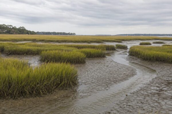
Tybee Island looks settled now, but geologically it is young. The present barrier island formed in the Holocene, roughly 4,000 to 5,000 years ago, over an older Pleistocene core that dates to about 35,000 years ago. That matters because it means the island is not a fixed mass of land. It is a body of sand assembled and reassembled by waves, wind, tides, and sediment.
People learned that long before colonial engineers did. Around 4,500 years ago, Indigenous communities occupied Tybee, Little Tybee, and Wassaw. Shell rings still mark that older coastal world. The Euchee, also spelled Yuchi, were among the Native peoples associated with the island. They gathered shellfish, hunted game, and collected salt. The name Tybee is widely thought to come from a Euchee word connected to salt, though historians do not treat that interpretation as entirely settled.
That history deserves to stay in view. Europeans did not discover an empty shore. The island was already part of an Indigenous landscape before Lucas Vázquez de Ayllón claimed the area for Spain in 1520 as part of La Florida, and before French visitors came in 1605 looking for sassafras roots. In the 1830s, the remaining Euchee were forcibly removed to Indian Territory, in present-day Oklahoma. Later defenses and navigation works rose on ground already shaped by displacement.
Why the lighthouse came before the beach town
The logic of Tybee was always maritime. Anyone approaching Savannah by sea had to reckon with this stretch of coast, which is why General James Oglethorpe ordered both a tower and a fort here in the 1730s. The first lighthouse on Tybee Island was completed in 1736. At 90 feet, or 27.4 meters, it was the tallest structure of its kind in America at the time.
Yet it was not really a lighthouse in the sense most people imagine. It had no lamp. It worked by silhouette and height, a daytime signal at the river entrance. Even that proved difficult to maintain. In August 1741, a storm washed the tower away.
A second structure, built of stone and wood, was completed in March 1742. It too lacked illumination. The problem was larger than architecture. Building on a barrier island means building on a surface that keeps changing shape. By 1768, the Georgia Assembly had authorized a third tower because the sea was already threatening the foundation of the second. The shoreline was not background scenery. It was an active force in public policy.
That third tower, a 100-foot brick structure, was completed in 1773. Only after the property passed to the federal government in 1790 was it lit, in 1791, using spermaceti candles. Read as a sequence, the dates can feel tidy. Read as a pattern, they tell a rougher story. Again and again, Tybee demanded rebuilding. Navigation here depended on engineering, and engineering had to answer to erosion.
A military edge, not a remote shore
The same position that mattered to mariners mattered in war. Tybee guarded the maritime approach to Savannah, so control of the island could shape events inland.
During the American Revolution, that role became plain. In 1776, Royal Governor Sir James Wright escaped to a British man-of-war in Tybee Roads. Patriot forces then raided and destroyed houses that had sheltered British officers. In 1779, the French fleet under Count d’Estaing anchored off Tybee for two months during the Siege of Savannah.
None of this was incidental activity on an out-of-the-way beach. The island sat at Savannah’s front door.
Local legend adds pirates to the story. Tybee is often said to have offered them shelter and a place to hide treasure. That belongs to tradition rather than documented history, but the legend fits the geography well enough: shifting channels, a river mouth, nearby cover, and a coast difficult to read unless you knew it.
The light became more precise, then became a target
By the early nineteenth century, navigation at Tybee had grown more exact. In 1822, a second tower was added to create a range, allowing mariners to align two markers and hold the channel more safely. In 1857, both towers received Fresnel lenses: a second-order lens in the main tower and a fourth-order lens in the front tower. The island had moved beyond simple daymarks and candlelight into a more modern navigational system.
Then the Civil War turned the beacon into a liability. In 1861 and 1862, Confederate troops burned the lighthouse and removed its lens so Union forces could not use it. That was not random destruction. A working light at the mouth of the Savannah River could aid an invading navy as easily as merchant shipping.
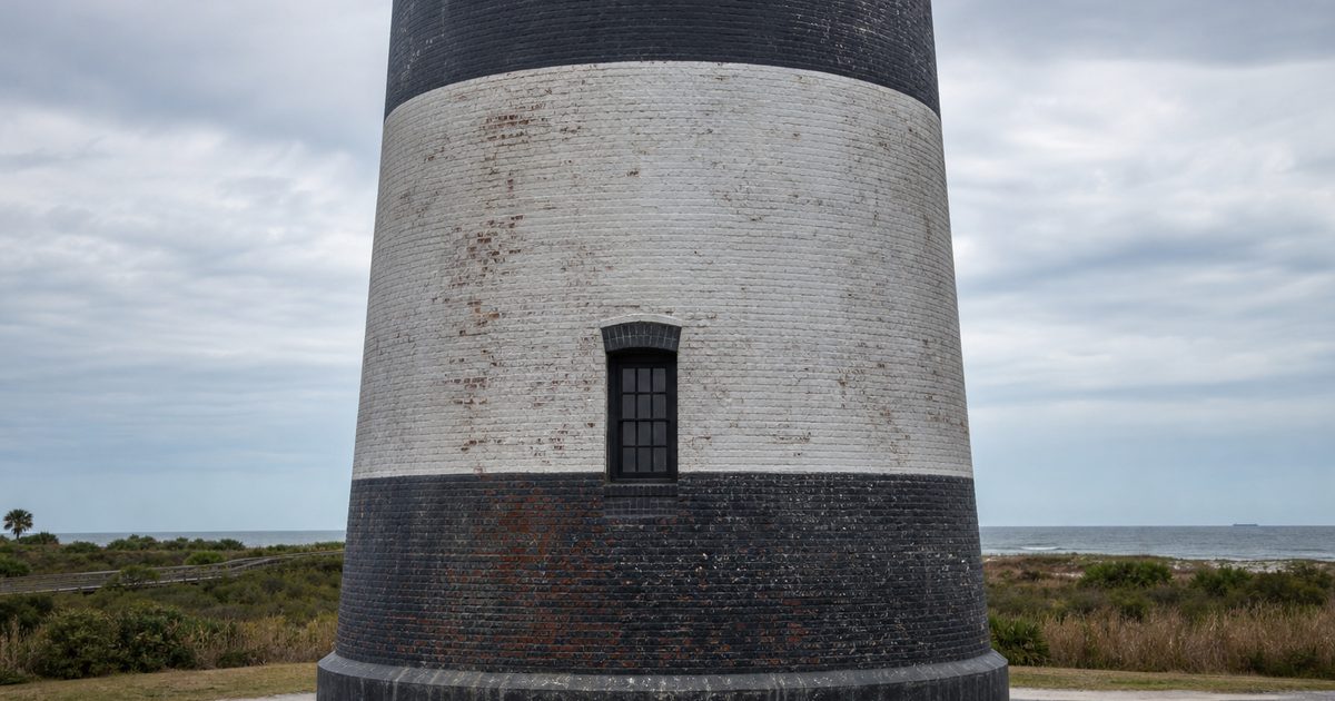
The tower that stands now emerged from that damage. Reconstruction began in 1866, using the lower 60 feet, or 18.3 meters, of the 1773 structure as a foundation. The rebuilt lighthouse was first lit on October 1, 1867. It rose to 46.9 meters and combined brick with cast iron. It also received a first-order Fresnel lens.
That makes the present Tybee Island Light Station less a single monument than a layered object. Part of the eighteenth-century tower survives inside a nineteenth-century rebuilding, itself the result of wartime destruction. The structure is cumulative. It carries the island’s habit of repair in its walls.
Forts built on uncertain ground
The forts on Tybee follow the same basic logic. Oglethorpe’s small fort of 1736 was meant to control access to the Savannah River. Later military works did much the same. The island was useful because it sat near the channel. It was vulnerable because barrier islands are exposed by nature.
Fort Screven Historic District still shows that long military effort to secure a strategic edge. But the setting matters as much as the masonry. No fortification here ever escaped the larger coastal system around it. Beaches narrow and widen. Sand shifts. Shorelines migrate. Tybee itself moves westward over time under the pressure of waves, wind, and sediment carried by the Savannah River.
So a fort on Tybee was never just a fort. It was an attempt to hold a position on terrain that does not fully agree to being held.
The shoreline is the real main character
The longest story on Tybee is not military or architectural. It is coastal. The lighthouse, the batteries, the roads, the seawalls: all of them are responses to a shore in motion.
That motion is natural, but it has also been intensified by human intervention. Dredging in the Savannah River and the construction of jetties have increased erosion on the island. In the account given by the island’s own coastal history, those works are responsible for about 73 percent of Tybee’s sand loss. That figure matters because it turns erosion into something more specific than a vague complaint about storms. Harbor engineering altered the island’s sediment budget.
The response has been engineering of another kind. Since 1975, the U.S. Army Corps of Engineers has carried out regular beach nourishment on Tybee. Groins, seawalls, revetments, and added sand all form part of the modern landscape. None of these are ornamental. They are evidence of an ongoing negotiation between moving water and fixed property.
Dune restoration adds another layer. Native plantings, including 77,000 sea oats, have been used to strengthen the island’s dunes, with monitoring to track how those systems hold up. The aim is not to freeze the coast in place forever. A barrier island does not permit that fantasy. The aim is to make it more resilient to storms, flooding, and daily wear.
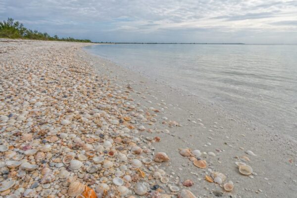
That is why the shoreline can look contradictory at first glance. Some ridges are natural beach and dune forms. Others have been reinforced. Some stretches are armored. Others are buffered with nourished sand. Tybee’s coast is not simply vanishing, and it is not simply saved. It is being managed while it continues to change.
What the light station still shows
The Tybee Island Light Station and Museum matters partly because it preserves more than a tower. Many American lighthouses survive as isolated landmarks, detached from the working complexes that once made them function. Tybee still retains its historic support buildings, which is why it is often described as one of the country’s most intact light stations.
Its later history follows the broader shift in lighthouse technology and administration. In 1933, the light changed from kerosene to electricity. In 1939, the U.S. Coast Guard took over operations. In 1987, Coast Guard operations moved to Cockspur Island. Since 2002, the Tybee Island Historical Society has operated the site.
The station also preserves a first-order Fresnel lens and includes the 1916 daymark. That detail is easy to miss, but it matters. Tybee’s navigational history was never about one heroic tower standing alone. It was about systems: paired markers, channel alignments, changing technologies, and constant adaptation to a coast that would not stay still.
Reading Tybee in layers
What remains visible on Tybee Island today is not one era but several, stacked awkwardly together. The lighthouse rises on a site where earlier towers were washed away, undermined by the sea, burned in war, and partly absorbed into later rebuilding. Fort Screven marks the island’s military role. Along the shore, groins, revetments, seawalls, and nourished beaches show the modern attempt to slow erosion without pretending it can be ended.
Even conservation fits the old pattern of close attention to the edge. At the north end of the island, wildlife beach areas help reduce disturbance to shorebirds and seabirds. The Tybee Island Marine Science Center focuses on sea turtles, diamondback terrapins, shorebirds, seabirds, and marine mammals. Coastal change is also monitored by researchers, including the University of Georgia’s Skidaway Institute of Oceanography, which tracks shoreline change and the effects of nourishment.
The old daymark at the river mouth has become a museum piece, but the island has not stopped doing the work that created it. People still watch this coast closely because they have to. Tybee remains what it was at the start: a working edge where navigation, defense, and erosion keep meeting on the same narrow strip of sand.
FAQ
What is the oldest structure on Tybee Island?
The Tybee lighthouse is the island’s oldest surviving structure. The current tower incorporates the lower 18.3 meters, or 60 feet, of the 1773 lighthouse.
Why is Tybee Island’s coastline changing?
Tybee is a barrier island, so wind, waves, and sediment naturally move its shoreline. Dredging and jetties near the Savannah River have also increased sand loss.
When was the first lighthouse on Tybee Island built?
The first tower was completed in 1736. It was a daymark rather than a lit beacon and was washed away in a storm in 1741.
What role did Tybee Island play in the Civil War?
Confederate troops burned the lighthouse and removed its lens to keep it from aiding Union forces. The island’s position at the mouth of the Savannah River made it strategically important.
Who were the original inhabitants of Tybee Island?
Indigenous peoples lived on Tybee thousands of years before European colonization. The Euchee, or Yuchi, were among the Native communities associated with the island.