Four millennia before anyone spoke of fairways, gates, or oceanfront rentals, people on what is now Hilton Head Island built rings of shell up to 73 meters across and 2.7 meters high. They remain in the ground today, older than the pyramids at Giza, and they set the scale for the island’s real story. Hilton Head did not begin as a resort. It began with tide, marsh, labor, and long human presence.
That matters because the island’s modern image can flatten it. The beaches are real, and so is the development that made Hilton Head famous. Yet the place is best understood through the layers that still sit close together: ancient Native occupation, plantation slavery, the making of a Gullah landscape, and an unusually influential experiment in planning at Sea Pines. If people ask what Hilton Head Island is known for, the honest answer is not a single attraction. It is the way those layers still shape one another.
Before the resort, a lived-in island
Hilton Head lies in Beaufort County in South Carolina’s Lowcountry, a barrier island northeast of Savannah and southwest of Charleston. Its map tells you something important at once: water takes up a large share of it. Of the island’s 179.0 square kilometers, 107.1 are land and 71.9 are water. Creeks, marsh, and tidal edges are not margins here. They are structure.
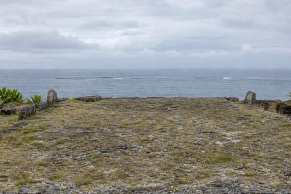
People used this island thousands of years before any European surveyor named it. The article’s earliest period is the Archaic, dated here to 8000 to 1000 BCE, and it identifies the Escamacu as one of the Native groups associated with the island. The clearest surviving evidence is the shell ring in Sea Pines Forest Preserve. Archaeologists still debate its exact purpose. It may have accumulated through everyday harvesting and discard; it may also have had ceremonial meaning. What is not in doubt is the age and implication of the site. This was a settled coastal world with its own seasonal rhythms long before plantations or tourism.
European claims came much later. Spanish visitors are first confirmed in 1521. In 1663, the English captain William Hilton surveyed the area and named a headland Hilton’s Headland. The island later formed part of Bayley’s Barony, granted in 1698, and was also known as Trench’s Island. In 1717, John Barnwell received 1,000 acres.
Those changing names were not just cartographic trivia. They marked a transfer of power over land, and soon over labor, into a colonial system that would reshape the island.
The plantation coast and the making of Gullah Hilton Head
A single crop altered Hilton Head’s place in the Atlantic world. In 1790, William Elliott raised the first successful crop of long-staple Sea Island cotton on the island. The plant thrived in the coastal climate, and the profits drew planters quickly. By 1860, 24 plantations operated on Hilton Head.
That economy depended on enslaved Africans and their descendants. Their labor made the plantations possible; their knowledge of agriculture and coastal life helped sustain them. Out of that violent system emerged Gullah culture and language, one of the most distinctive African American cultural traditions in the United States.
The language is a creole, shaped by West African languages and English under the conditions of slavery. Local tradition says enslaved people developed Gullah in part as a way to communicate beyond the understanding of slaveholders. That should remain where it belongs: in tradition. What can be stated firmly is that Gullah developed among enslaved Africans in the coastal South and became a durable language of community, kinship, and memory.
On Hilton Head, that culture was tied to land and water. Marshes, small plots, fishing grounds, and local routes mattered after emancipation as much as they had before it. The island’s relative isolation helped preserve that world.
Mitchelville and freedom on the island
The Civil War broke the plantation order with unusual speed here. Union forces captured Hilton Head in November 1861 after the Battle of Port Royal Sound. The island then became a Union base and a place of refuge for thousands of formerly enslaved people.
In 1862, Mitchelville was established on Hilton Head. It is widely recognized as the first self-governing town of formerly enslaved African Americans in the United States. That distinction is not ornamental. Mitchelville was a working community, not a symbolic gesture. Residents built homes, created institutions, and governed themselves while the war still raged.
This is one of the central facts in Hilton Head history. It shifts the island away from the usual resort narrative and places it inside a larger American story about emancipation, autonomy, and land. After the war, Gullah neighborhoods remained, especially in the northern part of the island. For decades, people lived by small-scale farming, hunting, fishing, worship, and family networks that held cultural identity in place.
Any account of Hilton Head that lingers only on scenery misses this. The island’s beauty and its history are not separate subjects. The same creeks and marsh edges that now read as picturesque once formed the practical geography of survival.
Why the marsh matters
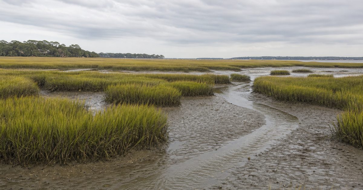
Stand on a boardwalk at low tide and the marsh can seem almost still. Mud shows. Creeks narrow. The wind moves through the grass in long, even bands. Then the tide turns, and the whole system reveals what it is: not empty ground waiting for water, but a living engine.
Hilton Head’s salt marshes belong to the wider Beaufort County marsh system, which the article places at more than 80,937 hectares. Their dominant plant is smooth cordgrass, Spartina alterniflora, which can reach 1.5 to 1.8 meters in summer. That grass gives the marsh its visual signature, but its ecological work matters more. It shelters juvenile blue crabs, shrimp, flounder, menhaden, mullet, and oysters. Higher zones support black needlerush, sea lavender, saltgrass, and saltwort.
Birds and larger animals move through the same system: egrets, pelicans, bald eagles, alligators, manatees, and Atlantic bottlenose dolphins. The marsh also filters water as tides pulse through it. For a barrier island, that productivity is not background detail. It underpins fisheries, water quality, and the broader resilience of the coast.
This is one reason the island exists in the form it does. It is also one reason development on Hilton Head could never be only a matter of roads and lots. Build carelessly on a barrier island and you do not just change the view. You damage the nursery, the filter, and the edge that makes habitation possible.
Sea Pines and a different development logic
By the mid-20th century, Hilton Head was poised for transformation. In 1956, Charles E. Fraser began Sea Pines Resort, the first development on the island and the project that would define its modern reputation. The tract covered more than 2,023 hectares, or 5,000 acres.
Sea Pines matters because it offered a different model from the blunt coastal development common in its era. Fraser’s plan tried to fit roads, houses, and amenities into the existing landscape rather than clear the landscape and start over. Covenants and deed restrictions aimed to protect the island’s visual and ecological character. The project included 245 hectares of forest preserve. Later, the town adopted ordinances to protect trees and reduce development impact more broadly.
That does not make Sea Pines innocent. Large-scale resort development always changes a place, often in ways that raise land values, alter access, and pressure older communities. But the form of the change on Hilton Head became influential because it treated maritime forest and marsh as assets to be retained, not obstacles to be erased.
A small story captures the idea better than any slogan: Fraser reportedly changed the layout of Harbour Town marina to save an old live oak. Whether one sees that as principle or branding, it tells you what kind of image Sea Pines wanted to project. The landscape was not supposed to disappear behind the resort. It was supposed to remain visible enough to define it.
Harbour Town’s striped lighthouse, built in 1969, became the postcard symbol. The deeper legacy lies elsewhere, in planning rules, preserved green space, and the notion that a resort community could be designed around ecological limits, however imperfectly.
The tension that still defines Hilton Head
Sea Pines helped shape what many travelers now imagine when they think of the island. It also created a lasting contradiction. The same place often described as an eco-planned community became a major vacation destination receiving 2.5 million visitors annually, according to the article.
That tension is not incidental. It is the central modern fact of Hilton Head. Protection and pressure arrived together. Tree ordinances, conservation purchases, and preserved tracts helped keep the island from looking like many overbuilt stretches of the American coast. At the same time, popularity drove the very growth those measures had to contain.
The article notes that since 1991, the Town of Hilton Head Island has purchased nearly 529 hectares for conservation. The Hilton Head Island Land Trust, founded in 1987, protects about 121 hectares of natural habitat. Groups such as Hilton Head Audubon have also worked to defend the ecological fabric of the island.
Those numbers matter less as accolades than as evidence of an ongoing argument over what the island is for. Is it primarily a commodity, a habitat, a home, a historical landscape? Hilton Head has never settled that question cleanly. Sea Pines did not solve it. It simply gave the debate a more careful vocabulary.
What survives in plain sight
Some places hide their past under asphalt and replacement architecture. Hilton Head still leaves much of its history exposed if you know where to look.
The Sea Pines Shell Ring keeps the island’s earliest known human story in the landscape itself. Historic Mitchelville Freedom Park anchors the history of emancipation and Black self-government in a physical site, not just in archival memory. Baynard Ruins preserve part of an antebellum plantation house. The ruins of Zion Chapel of Ease, later used as a Civil War hospital, hold another fragment of the wartime island.
These are not separate attractions loosely gathered on a map. Together they explain what Hilton Head Island is known for beyond the beach. The shell ring shows deep time. The plantation ruins show the wealth built by slavery. Mitchelville shows freedom claimed and organized. Sea Pines shows the modern attempt to develop without fully severing the island from its ecology.
Around all of them lies the same marsh-and-forest setting that shaped each era in turn. That continuity may be the island’s most unusual feature. The landscape is not a backdrop pasted behind history. It is one of the main actors in it.
FAQ
What is Hilton Head Island known for?
Hilton Head Island is known for more than beaches and golf. Its deeper identity includes ancient shell rings, Gullah heritage, the history of Mitchelville, extensive salt marshes, and the planning legacy of Sea Pines.
What is Sea Pines on Hilton Head?
Sea Pines is the island’s first large-scale modern development, begun by Charles E. Fraser in 1956. It became influential for planning that tried to preserve trees, forest, and marsh character within a resort setting.
Why are the marshes on Hilton Head important?
They support juvenile fish and shellfish, help filter water, and shape the island’s coastal resilience. Smooth cordgrass, or Spartina alterniflora, is the dominant marsh plant.
Who are the Gullah people on Hilton Head Island?
The Gullah are descendants of enslaved Africans in the coastal South who developed a distinct creole language and culture. On Hilton Head, that heritage remained strong after the Civil War, helped by the island’s relative isolation.
What is Mitchelville on Hilton Head?
Mitchelville was established in 1862 and is widely recognized as the first self-governing town of formerly enslaved African Americans in the United States.