A shell ring on the north end of St. Simons Island predates Fort Frederica by millennia. That contrast explains the place better than any brochure ever could. On this barrier island off the Georgia coast, history does not sit in one preserved quarter. It lies in marsh-edge earthworks, mission sites, tabby ruins, churchyards, schoolhouses, and in the surviving geography of Gullah Geechee communities.
What makes St. Simons unusual is not simply age. Plenty of coastal places are old. It is the compression. Within roughly twelve miles, the island holds evidence of Late Archaic settlement, Indigenous chiefdoms, Spanish colonization, a British military frontier, plantation slavery, wartime emancipation, and the long afterlife of those systems in land ownership, memory, and preservation. To walk St. Simons Island history is to move through a sequence of coastal regimes, each one built on the ground left by the last.
The first settlements in the marsh country
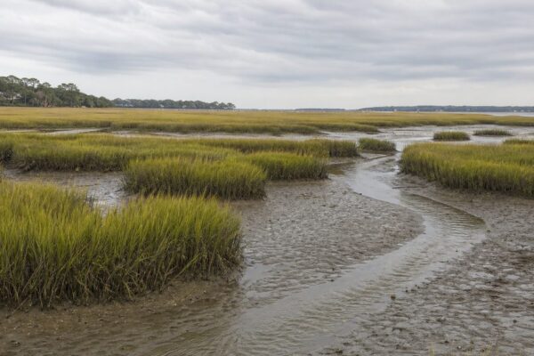
The deepest visible layer survives in shell. At Cannon’s Point Preserve, on the island’s north end, middens and a Late Archaic shell ring date to around 2500 BCE. These remains are among the earliest signs of human habitation on St. Simons. They are not ruins in the familiar sense. They are accumulations of daily life: shell, food waste, repeated occupation, and the pattern of people who knew how to live with tides, creeks, and estuaries.
That matters because it places the island inside a much older coastal world. Long before European empires treated this shoreline as a strategic edge, Native communities used it as part of a network of fishing grounds, hunting territory, waterways, and seasonal movement.
Before 1500, the Guale chiefdom centered on St. Catherines Island used St. Simons as hunting and fishing territory. By about 1500, a permanent village called Guadalquini stood here, with a population of roughly 200. The Mocama, a Timucua-speaking people whose range extended from the Altamaha River to St. Augustine, also occupied this stretch of coast. A Mocama village of perhaps 100 to 200 people stood at what is now St. Simons Park.
These details do more than fill a timeline. They correct an old habit of seeing barrier islands as empty thresholds awaiting European arrival. St. Simons was already inhabited, named, and organized.
Spanish missions and an imperial shoreline
The first European claim came early. In 1562, Jean Ribault visited and claimed the island for France. French ambitions on this coast did not last. Spain soon asserted control, and the region became part of a larger imperial contest that stretched along the southeastern seaboard.
Some historians debate the exact location of French Fort Caroline, and one theory places it near the Altamaha River close to St. Simons. The uncertainty is worth keeping. It is a reminder that not every colonial episode survives in neat cartographic form. The broader point is secure: this coast had become contested ground.
By 1568, the Spanish had begun establishing Catholic missions along the Georgia coast. On St. Simons, two missions took shape during the seventeenth century: San Buenaventura de Guadalquini at the southern end and Santo Domingo de Asao at the northern end.
Those missions were instruments of colonization, not isolated chapels in a wilderness. Spain used them to draw Native communities into its political and religious system. That process altered local power, labor, and allegiance. It also tied the island to a chain of mission settlements that linked the Sea Islands to St. Augustine and beyond.
The mission era ended violently. In 1684, pirate raids and Native attacks led to the abandonment of Spanish missions and villages on the island. One colonial order withdrew. Another soon arrived.
Fort Frederica and the British frontier
When James Oglethorpe founded Savannah in 1733, Georgia was still a fragile British project. St. Simons became crucial three years later. In 1736, Oglethorpe returned with settlers and soldiers, among them John and Charles Wesley, and established Fort Frederica on the island.
The choice was strategic. This was the southern edge of Britain’s Georgia colony, exposed to Spanish Florida. Fort Frederica was built to hold territory and stop invasion, not to create a genteel town. The settlement formed part of a defensive chain on a disputed coast.
The remains now preserved at Fort Frederica National Monument can look modest to a visitor expecting a stone fortress. Their importance lies in context. The site was the center of a frontier experiment in which military planning, imperial rivalry, and settlement policy all met on a narrow piece of marsh-bound land.
That struggle reached its best-known moment on July 7, 1742, at the Battle of Bloody Marsh. British and Scottish troops defeated a larger Spanish force, helping end the immediate threat of Spanish invasion into Georgia. Local tradition says the marsh ran red with blood. The phrase endured because the battle settled something larger than a skirmish. Still, the image belongs to legend, not to verified battlefield description.
After Bloody Marsh, British control in Georgia was effectively secured. The island no longer needed to function only as a garrison frontier. That shift opened the way for a harsher economy.
Sea Island cotton and the plantation order
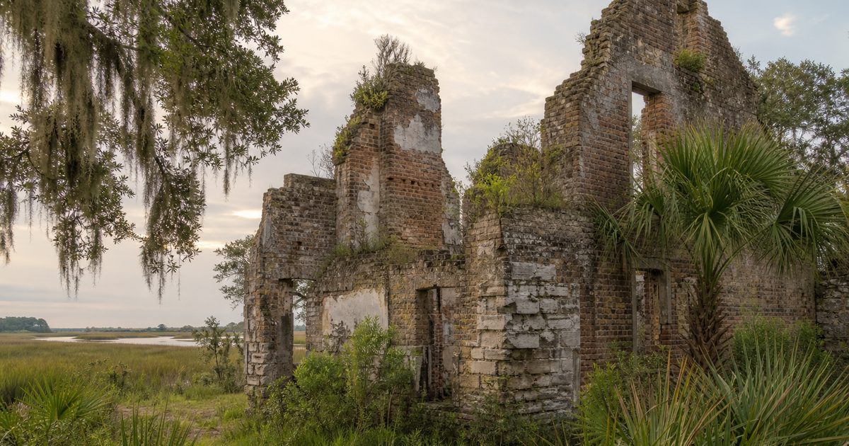
By the late eighteenth century, Fort Frederica had outlived its military purpose. Its tabby ruins were quarried for plantation buildings. The reuse was practical, but it also feels symbolic. Materials from a frontier fort became part of a slave plantation landscape.
From the 1780s until 1861, plantation agriculture reshaped St. Simons. The island became known for long-staple Sea Island cotton, a lucrative crop tied to Atlantic markets and dependent on enslaved labor. Timber also left these shores; the island supplied wood for American ships, including the mast post of the USS Constitution.
Retreat Plantation, established after William Page purchased land there in 1804, became one of the island’s leading cotton estates. But no account of this period should linger on agricultural success without naming its human cost. The wealth of St. Simons rested on coercion, surveillance, and the sale of people’s labor.
Resistance belongs in the same story. In 1803, a group of captive Igbo people reportedly rebelled after landing at Dunbar Creek, also known as Ebos Landing, and drowned themselves rather than submit to enslavement. The event holds deep significance in local memory and in Gullah Geechee tradition. Because the record is shaped by history and remembrance alike, it is best described carefully: as a powerful historical account carried with sacred force in community tradition.
The plantation era also shaped the culture that outlasted it. Descendants of enslaved Africans on the Sea Islands and adjacent mainland developed the language, foodways, spiritual practices, and kinship traditions now known as Gullah Geechee culture. On St. Simons, communities such as Harrington, Jewtown, and the South End preserve that inheritance. This is not a decorative layer of local color. It is one of the island’s central historical continuities.
War, emancipation, and Black landholding
The Civil War broke the plantation system here with unusual speed. In 1861, Confederate troops occupied the island. In February 1862, as they retreated, they blew up the original lighthouse to keep it from aiding Union forces. The destruction of a navigational beacon captured the logic of wartime denial: if the enemy might use it, destroy it.
Union troops occupied St. Simons in 1862 and established a contraband camp at Fort Frederica for formerly enslaved people. The settlement grew to thousands. In that unsettled space, freedom was not an abstract proclamation. It had to be organized in food lines, shelter, labor, worship, and schooling. Susie King Taylor, who would later become widely known for her Civil War memoir, taught freed children there.
Then came one of the most consequential turns in the island’s history. On January 16, 1865, Sherman’s Special Field Order No. 15 set aside coastal land for formerly enslaved families. President Andrew Johnson later reversed the order, but on St. Simons some freedmen retained land. That fact matters. In many parts of the South, emancipation did not produce durable Black control over property. Here, despite reversals and pressure, African American communities established roots that lasted.
After the war, plantation agriculture never fully recovered on the island. Former plantations declined. Freed people settled in places including Harrington and Jewtown. The result was not a clean break from the old order, but it was a real transformation. If the plantation years explain the violence that built St. Simons, Reconstruction helps explain who remained to shape it afterward.
What survives on the ground
The most striking thing about St. Simons is how much of this history still has a physical address.
At Cannon’s Point Preserve, the sequence runs from Native middens and a shell ring to plantation ruins within a protected landscape of roughly 600 acres. Few places on the Georgia coast show the depth of occupation so plainly.
Fort Frederica National Monument preserves the archaeological remains of Oglethorpe’s settlement. The Bloody Marsh Battle Site marks the 1742 clash that fixed the island in British imperial strategy. Christ Church, Frederica, though rebuilt and altered over time, maintains continuity with the Anglican presence established in 1736.
The African American story also remains legible in institutions and community landscapes. The Harrington School, now the Historical Harrington School Cultural Center, preserves the history of African American education and community life on the island. The St. Simons African American Heritage Coalition has worked since 2000 to protect sites, stories, and ancestral land connected to Gullah Geechee heritage.
Even the lighthouse belongs to this longer pattern. The current structure, built between 1868 and 1872 after the wartime destruction of its predecessor, marks the island’s postwar turn away from plantation production and toward maritime infrastructure, memory, and later tourism. It is often treated as a postcard emblem. In fact, it is part of the Reconstruction landscape.
A final caution belongs here. Preservation on St. Simons is not just about access. Some places carry sacred or community significance that should be approached with restraint. That is especially true of sites linked to enslavement, burial, and Gullah Geechee memory. Good history does not turn every surviving trace into a backdrop.
Reading the island as a whole
St. Simons Island is often described through attractions. That misses the point. The island’s real distinction lies in continuity and overlap. Indigenous settlement did not simply vanish into a prelude. Spanish missions did not float free of Native life. Fort Frederica did not stand apart from the plantation economy that followed. Emancipation did not erase the structures of the old order, yet it changed landholding and community formation in ways still visible today.
That is why St. Simons Island history feels unusually dense. The island is not a collection of separate sites. It is one coastal landscape where each regime reused, displaced, or built over the last. Shell became midden, mission ground became imperial frontier, fort ruins became plantation material, plantation land became freedpeople’s communities, and those communities now anchor preservation battles of their own.
On many islands, the past is curated into episodes. On St. Simons, it remains a structure.
FAQ
How old is the human history on St. Simons Island?
Evidence at Cannon’s Point Preserve dates back to the Late Archaic Period, with shell rings and middens from around 2500 BCE.
What was Fort Frederica on St. Simons Island?
Fort Frederica was a British settlement and military post founded by James Oglethorpe in 1736 to defend Georgia’s southern frontier against Spanish Florida.
What happened at Bloody Marsh?
On July 7, 1742, British and Scottish forces on St. Simons defeated a larger Spanish force. The battle helped end the immediate Spanish threat to Georgia.
Why is Gullah Geechee heritage important on St. Simons?
It reflects the enduring culture of descendants of enslaved Africans who lived and worked on coastal plantations. Communities such as Harrington and Jewtown remain central to that history.
What is the oldest historic site on St. Simons Island?
The oldest visible human-made remains are the Late Archaic shell ring and middens at Cannon’s Point Preserve, which predate the colonial sites by thousands of years.