A line of sand 113 miles long sounds solid on a map. Stand on South Padre Island in a stiff onshore wind and that impression falls apart. The beach shifts underfoot. Dunes fray at the edges. On the bayside, the Laguna Madre presses close, shallow and saline, reminding you that this is not a fixed coast but a narrow, moving partition between two waters.
That is the real subject of South Padre Island. Not the resort strip, not the seasonal crowds, but the barrier itself: a young landform on the Gulf Coast of Texas, still being built and taken apart by waves, currents, wind, storms, and rising water. The southern section of the Padre Island barrier system runs about 34 miles. The larger chain extends roughly 113 miles, making Padre Island the longest barrier island in the United States. Length, though, can mislead. What matters here is not scale but instability.
A young barrier on a restless shore
Geologically, South Padre Island is recent. Its earliest stage was likely a submerged sand body that began taking shape roughly 4,500 to 5,000 years ago, during the Holocene. The part recognizable as dry land appears to have emerged later, within the last 3,000 to 3,500 years.
That youth matters. It places the island among the most changeable coastal features rather than among old, settled landforms. South Padre Island did not rise as a single coherent mass. It developed through repeated movement of sediment: offshore bars building upward, spits extending under longshore drift, older sand bodies reworked as sea level changed. Coastal geologists still debate the exact balance among those processes, and the caution is useful. Barrier-island formation rarely follows one clean script.
For this stretch of Texas coast, the broad conclusion is firmer than the details. South Padre Island formed out of mobile sand in a changing sea-level setting. It remains mobile because the forces that created it never stopped acting.
Sand, shell, and the logic of instability
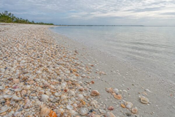
The island is made mostly of unconsolidated, well-sorted quartz and shell sand. That composition explains much of its character. Hard rock resists. Loose sand travels.
Mixed through those pale beach deposits are trace minerals such as magnetite, garnet, zircon, and tourmaline. They are small clues to a much larger sediment story. Rivers delivered material to the Gulf over long periods, and coastal processes then sorted and reworked it again and again before some of it became part of this barrier. The Rio Grande belongs to that story. So do other large river systems that fed the wider Gulf sediment budget. By the time those grains reached South Padre Island, they had already lived several geological lives.
The island’s surface records that movement. Beach ridges, dune fields, vegetated flats, and low back-barrier areas are not scenic extras. They are the structure of the place. The beach is the active edge, where wave energy picks up and drops sediment according to season and storm conditions. Dunes store sand above normal tides. Flats behind them offer temporary stability, especially where vegetation can take hold.
Temporary is the key word. On a barrier island, stability is usually a pause, not a permanent state.
How wind finishes what waves begin
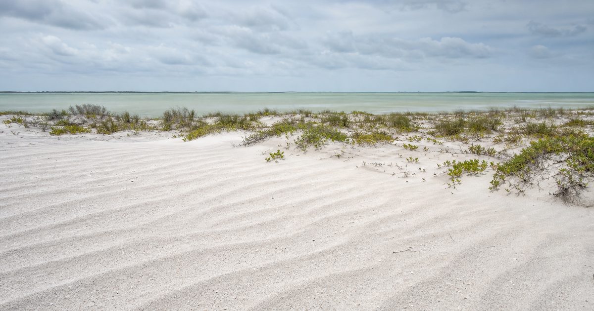
Watch the beach on a dry day and the process becomes visible. Waves leave sand behind. Wind lifts the finer grains and drives them inland. Small ridges gather around plants or debris. Over time those ridges become dunes.
These eolian processes are central to South Padre Island. Wind does not merely decorate the shoreline with sculpted forms. It helps build one of the island’s main protective features. Dunes act as sand reservoirs. During ordinary conditions they sit above the reach of daily tides. During storms they may erode, break, or migrate, but even that damage is part of the barrier’s larger cycle of redistribution.
Storms complicate everything. Overwash pushes water and sand across the island. Sediment can be carried from the Gulf side toward the lagoon, where it settles on lower ground. This is how a barrier island migrates landward. It does not simply erode away at the seaward edge. It can roll over itself, grain by grain, during extreme events.
That is one of the paradoxes of barrier island geology. The same mobility that makes these islands vulnerable is what allows them to persist. A rigid shoreline would fail differently. South Padre survives by shifting.
The Laguna Madre is half the story
Seen only from the surf side, the island can look like a beach with dunes behind it. The Laguna Madre corrects that view. West of South Padre Island lies a shallow hypersaline lagoon, one of the defining features of the region. Its presence means the barrier is part of a two-sided system, exposed to Gulf wave energy on one flank and quieter but still consequential lagoon processes on the other.
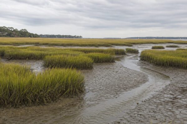
The bayside matters because sediment moves there too. Overwash fans, windblown sand, and changing back-barrier shorelines all shape the island’s interior and lagoon-facing edge. Wind tidal flats develop in this setting. So do low, vegetated surfaces that may seem settled until the next storm rearranges them.
This is why simple explanations fail. South Padre Island is not formed by “the ocean” in a general sense. It is produced by exchange between surf, wind, dunes, flats, and lagoon. The Gulf attacks and supplies. The bayside receives and records. The barrier sits in between, always adjusting.
Longshore drift, but not in one neat direction
Coasts invite oversimplification. One common version goes like this: sand moves steadily alongshore in a single direction. South Padre Island is messier than that.
Nearshore sediment transport along the South Texas coast is often predominantly northward, driven by breaking waves and longshore currents. In deeper water, transport patterns can differ, with southward movement influenced by currents and wave stirring. Seasonal changes alter wave climate and current behavior. Storms can briefly dominate the whole system, generating strong longshore flows and moving large volumes of sand in short periods.
So the puzzle of moving sediment here is not just where it goes, but under what conditions, at what depth, and on what timescale. That complexity matters because a barrier island depends on supply. If beaches and dunes receive enough replenishing sand, they can recover after erosion. If supply drops or is interrupted, retreat becomes harder to reverse.
Retreat is not an exception here
South Padre Island has been in a long-term erosional, landward-retreating phase. The causes are not mysterious, though their interaction is complicated: reduced or interrupted sediment supply, relative sea level rise, and repeated tropical storm impacts.
One local figure gives that process a measurable edge. Since 1958, sea level at South Padre Island has risen by about 17.8 centimeters, or 7 inches. On a low sandy barrier, that is not trivial. Higher water raises the baseline for storm surge, increases the reach of waves during extreme events, and makes dune erosion and overwash more likely.
The important point is that retreat does not mean the island is simply vanishing. Barrier islands often persist by moving landward. South Padre Island is still being made, but the making now includes loss, rollover, and reworking. In that sense, erosion is not the opposite of formation. It is part of the same coastal process.
Human settlement on a moving edge
People have long used this coast, though not always in ways that left durable marks on the sand. The Karankawa inhabited the broader region from deep antiquity; the article’s own chronology places their presence as early as the 5th millennium BCE, with a distinct cultural identity emerging much later. They lived within the barrier-lagoon world rather than against it, using seasonal camps, fishing, shellfish gathering, bird and turtle hunting, and dugout canoes suited to shallow water.
That history deserves plain language. By the 19th century, Karankawa communities had been devastated by disease, colonial intrusion, and frontier violence. Their relationship to this coast was not a romantic prelude to modern development. It was a long human adaptation to a difficult, productive, shifting environment.
The island also carries stories that belong to tradition rather than documented fact. “Lafitte’s Well,” near Laguna Vista, is locally said to have been dug by the privateer Jean Lafitte. That remains legend. Another tradition links the island’s name to Padre José Nicolás Ballí, remembered as a benevolent priest. Tradition and archive do not always align neatly on coasts like this, where memory often outlasts evidence.
Development versus the barrier’s own logic
Modern South Padre Island depends on a kind of stability the landform does not naturally promise. Roads, buildings, and tourist infrastructure work best when shorelines stay put. Barrier islands do not.
That tension runs through every discussion of the island’s future. Tourism brings more than one million visitors annually, and the resident population grew quickly over the late 20th century from a small base. Yet growth has unfolded on a barrier whose normal behavior includes overwash, dune migration, shoreline retreat, and sediment exchange across the island.
Conservation efforts make the contradiction visible rather than solving it. More than 6,200 acres on South Padre Island have been preserved by The Nature Conservancy and incorporated into the Laguna Atascosa National Wildlife Refuge. Those protected areas recognize that parts of the island function best when managed as habitat, not fixed real estate.
The same is true for sea turtles. Sea Turtle Inc. patrols nesting areas daily from April 1 through August 15, relocating eggs to a hatchery for safer incubation and releasing hatchlings when conditions allow. South Padre Island is the primary nesting ground in the United States for the critically endangered Kemp’s ridley sea turtle, the smallest sea turtle species in the world. That fact sharpens the larger point: the beach is not just a recreational surface. It is active habitat on an unstable coast.
What South Padre Island reveals
The island’s white sand, its dunes, and the hypersaline Laguna Madre beside it all point to the same conclusion. South Padre Island is not a permanent object but an ongoing process. It began as mobile Holocene sand. It remains mobile now.
Current coastal management reflects that reality, even when it tries to resist it. Research continues on sediment transport and shoreline change. Beach nourishment, including the use of dredged material, is one practical response to erosion. Such measures may buy time or protect infrastructure. They do not alter the basic nature of the place.
A barrier island can look settled for a season, even for a generation. South Padre Island is a reminder that coasts have longer rhythms. Wind lifts what waves leave behind. Storms cut through what calm weather seems to secure. The lagoon receives what the Gulf throws over. And the island, young by geological standards and restless by any standard, keeps moving.
FAQ
How was South Padre Island formed?
South Padre Island formed during the Holocene from mobile sand bodies such as submerged bars and shoals, then emerged as dry land over the last few thousand years through waves, wind, and longshore sediment transport.
Is South Padre Island the longest barrier island in the United States?
Padre Island as a whole is the longest barrier island in the United States, stretching about 113 miles. South Padre Island is the southern section of that larger barrier system.
What is South Padre Island made of?
It consists mainly of well-sorted quartz and shell sand, with trace minerals including magnetite, garnet, zircon, and tourmaline.
Is South Padre Island eroding?
Yes. The island is in a long-term phase of landward retreat driven by erosion, sea level rise, storm activity, and changes in sediment supply.
Why is the Laguna Madre important to South Padre Island?
The Laguna Madre shapes the island from the bayside. Overwash, windblown sand, and back-barrier processes help determine how the barrier evolves, not just Gulf waves alone.