A dark knob of basalt stands at the island’s northern tip, older and harder than almost everything around it. Warrior Rock belongs to a deeper story: Miocene Columbia River basalt and older volcanic rock. The rest of Sauvie Island is younger, softer, and endlessly revised by water. Mud, sand, sloughs, ponds, floodplain forest, and a broad interior lake all gathered here because two large rivers kept dropping, shifting, and reclaiming their load.
That contrast explains the place better than any map can. Sauvie Island may look fixed where the Columbia runs along its east side, the Multnomah Channel along its west, and the Willamette meets the system at the south. In fact, the island is a work of accumulation and rearrangement. At roughly 24,000 acres, about 17 miles long and 5 miles wide, it is the largest island on the Columbia River. Its real distinction, though, is not size. It is the way the island still reveals how a floodplain gets built, cut apart, diked, and partially rewatered.
Built around a hard core
The broad foundation of the island formed during the Pleistocene, over the last million years, as the Columbia and Willamette laid down sediment across the Portland Basin. Beneath the floodplain lies older rock, exposed at Warrior Rock. Above it sits the material that made the island itself: sand, silt, and mud delivered in repeated pulses.
One part of that story centers on Oak Island, a sandy core that formed roughly a million years ago. Later deposits gathered around it. Seasonal freshets spread fresh layers across low ground. Channels shifted, overflowed, and sometimes abandoned their old courses. What remained were swales, ponds, and lakes that still mark former paths of water.
The Missoula Floods added another dramatic chapter. Between about 15,000 and 20,000 years ago, those cataclysmic floods swept through the region and left vast amounts of sediment in the Portland Basin. Sauvie Island was not yet the settled shape seen today, but the floods contributed to the material from which it emerged. The island feels local and self-contained now. Geologically, it was assembled from a watershed that reaches far upstream.
That matters because the wetlands here were not an afterthought. Sloughs, shallow lakes, and wet ground were the natural result of flood deposition at a river confluence. The island did not begin as dry land later interrupted by marsh. It began as a watery landscape that only intermittently behaved like firm ground.
When water cut the island free
For much of its earlier history, this land was attached to the mainland. Two to three thousand years ago, it separated as the Multnomah Channel formed along the west side. The exact cause is still debated. Flooding may have opened the channel. Rising sea level may have helped. The text of the landscape preserves the result more clearly than the mechanism.
Once that western channel existed, the land sat between major flows rather than beside one. Water could press in from several directions, spread across low areas, and retreat into side channels and backwaters. That made the place unusually dynamic. Instead of one dominant terrain, a mosaic developed: tidally influenced sloughs, ponds, wetlands, cottonwood stands, and bottomland hardwood forest.
Even after later diking and farming altered the pattern, the island kept this underlying logic. Its shape came from hydrology first. The soils and habitats followed.
Wapato Island and the value of marsh
Long before the name Sauvie attached to the place, it was known as Wapato Island. Earlier still, the Multnomah people, a Chinookan group, called it Wakanasese. They had lived here for thousands of years. Before Euro-American settlement, the island supported a dense Indigenous population, often described as one of the highest north of Mexico. The text places that population in 15 villages and gives a range of 2,000 to 6,000 people.
That density was possible because the wetlands fed it.
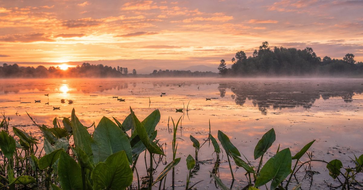
Wapato, Sagittaria latifolia, grew abundantly in the island’s marshes and shallow waters. Its edible tubers were a staple food and a trade good. People harvested them from the mud, then roasted, dried, stored, and exchanged them. The old name is precise in a way modern naming often is not. It identifies the plant that made the wet ground valuable.
That point is easy to miss in a landscape later shaped by drainage and agriculture. Marsh was not empty land awaiting improvement. It was a working food landscape. Settlement did not happen despite the wetlands. It depended on them.
Part of that long relationship survives in the archaeological record at Sunken Village, a wet site at the island’s southern end and a National Historic Landmark. The same saturated ground that can erase traces of life also preserves them. Finds there include acorn leaching pits and basketry, reminders that waterlogged places can hold memory in unusual ways.
Mapping, epidemic disease, and a new name
Lewis and Clark mapped the island in 1805 and 1806 and recorded it as Wappatoe Island. Their name reflected what the place was known for. Within a few decades, that human landscape had been shattered.
In the early nineteenth century, smallpox struck Indigenous communities in the region. In the 1830s, a malaria epidemic often called ague followed. The text describes the effect bluntly and rightly: near eradication of Native communities on the island. Any account of Sauvie Island that lingers only on wetlands and birds misses this rupture. The marshes endured. The people whose lives were tied to them suffered catastrophic loss.
Around 1836, the Hudson’s Bay Company established dairies on the island under Laurent Sauvé, a French-Canadian dairyman. His surname later became the island’s English name. In the late 1840s, Euro-American settlers arrived, and after the Donation Land Act of 1850 they claimed land there. The shift from Wapato Island to Sauvie Island was not a neutral relabeling. It marked a transfer of power, land use, and public memory.
The Confederated Tribes of Grand Ronde continue to maintain cultural ties to the island and to the chiefs who lived there. That continuity belongs in the story, especially in a place where so much of the visible surface has been remade.
Dikes and the remaking of the wetland mosaic
The decisive modern intervention came in the 1920s, when dikes were built to protect farmland from annual flooding and to increase the amount of reliable tillable land. The reasoning was practical. Floodplain soils were fertile, but water made them unpredictable. Dikes promised control.
They also broke old connections.
Regular exchange between river and wetland diminished. Sturgeon Lake, near the center of the island, was among the clearest casualties. Natural links to the Columbia River were effectively cut off. Sediment built up. Water stagnated. A landscape formed by movement began to suffer from stillness.
This is the central tension in Sauvie Island’s modern history. The same conditions that created rich wetlands also frustrated agriculture. Efforts to stabilize the land protected one use while degrading another. Farming remains one of the island’s defining realities, and state land-use policy later preserved its agricultural role. But the diking era also set the terms for later restoration, because it made the ecological costs impossible to ignore.
Those costs extended beyond water levels. Introduced species, including grass carp, bass, and catfish, altered the lake’s ecology. By disturbing bottom sediments, they damaged native wetland plants such as wapato and displaced native fish communities. A wetland mosaic is not just a pattern visible from above. It is a living system of flows, plants, and animals. Change the flows and the rest follows.
A refuge inside a working island
The north end of the island took a different path in 1947, when the Oregon Game Commission, now the Oregon Department of Fish and Wildlife, established the Sauvie Island Wildlife Area. Covering more than 11,000 acres, it was created chiefly for waterfowl habitat and public hunting. In effect, it kept a large share of the floodplain from being fully converted.
That protected ground now supports at least 275 bird species, 37 mammal species, and 12 reptile and amphibian species, according to the figures in the text. Its importance is tied to geography. The island lies on the Pacific Flyway, and Sturgeon Lake serves as a stopover for migratory birds as well as winter habitat for juvenile salmon. Large numbers of waterfowl use these wetlands seasonally.
The result is not a pristine wilderness and not a wholly engineered farm island. It is a working landscape where diked fields, managed impoundments, sloughs, and remnant channels sit side by side. That juxtaposition is the point. Sauvie Island still shows the argument between confinement and overflow.
One geographic oddity captures that layered character neatly: the interior lake. Sturgeon Lake is often described as the largest lake on a river island in the United States. Whether one arrives at it by map or by canoe, the arrangement is striking: a lake inside an island inside a river system. Novelty is not the real value here, though. The lake is evidence of how former channels can persist in a flood-built landscape.
Letting water move again
Restoration on Sauvie Island has increasingly focused on a simple idea: if altered flow damaged the wetlands, some recovery depends on restoring flow. Sturgeon Lake became the clearest test case.
The Sturgeon Lake Restoration Project, completed in 2019, reopened a channel between the lake and the Columbia River. The goal was to improve flushing, reduce sediment buildup, and create better habitat for juvenile salmon. More broadly, managers have tried to increase water exchange and reduce stagnation in the lake.
That work does not return the island to some untouched earlier state. It cannot. Sauvie Island remains inhabited, farmed, and heavily visited. Recreation brings its own pressure on wildlife, and management rules reflect that reality. Some areas close seasonally to protect waterfowl. Access is regulated. The wetland system is not simply there to be admired; it has to be managed because so many uses now converge on it.
The long-term effects of the Sturgeon Lake project still require continued observation. The text notes that winter and year-to-year data are needed to judge how fully the reopened channel can improve water flux and reduce sedimentation over time. That caution matters. Restoration is often discussed as if it were a clean reversal. Here it is better understood as an experiment in giving a flood-built place some of its movement back.
Reading the island now
Sauvie Island is still legible if you read it in the right order. Start with Warrior Rock, where the hard volcanic base breaks through. Then look across the low interior, where Sturgeon Lake occupies an old watery depression that never quite became stable land. Move north into the wildlife area, where wetlands, sloughs, and lakes preserve much of the floodplain pattern. At the southern end, Sunken Village holds evidence of the Multnomah people whose lives were bound to this ground long before dikes and bridges.
What emerges is not a scenic summary but a sequence of causes. Pleistocene deposition built the base. Major floods added mass. Channel formation cut the land free. Wetlands supported dense human settlement and a wapato-based economy. Epidemic disease and colonization ruptured that world. Dikes redirected water. Farming and introduced species changed the ecology. Restoration has tried, carefully and incompletely, to reopen what was closed.
At the confluence of the Columbia and Willamette, land has never stayed separate from water for long. That is the enduring fact of Sauvie Island, and the wetland mosaic is its clearest expression.
FAQ
How did Sauvie Island form?
Sauvie Island formed over the last million years as the Columbia and Willamette Rivers deposited sand, silt, and mud across the floodplain. Later floods, shifting channels, and the formation of the Multnomah Channel shaped it into an island.
Why was Sauvie Island once called Wapato Island?
The earlier name referred to wapato, Sagittaria latifolia, a wetland plant with edible tubers that was an important food and trade resource for the Multnomah people.
What is Sturgeon Lake on Sauvie Island?
Sturgeon Lake is a large interior lake near the center of the island. It is often described as the largest lake on a river island in the United States and is important for migratory birds and juvenile salmon.
Who lived on Sauvie Island before settlers arrived?
The island was home to the Multnomah people, a Chinookan group, who lived in multiple villages there for thousands of years and relied heavily on the island’s wetlands.
Why are the wetlands on Sauvie Island so important?
They reflect how the island was formed and they support a rich floodplain ecosystem. The wetlands also shaped human life here, first as a source of food and trade, and later as habitat now managed within the Sauvie Island Wildlife Area.